Contour DWG Block for AutoCAD

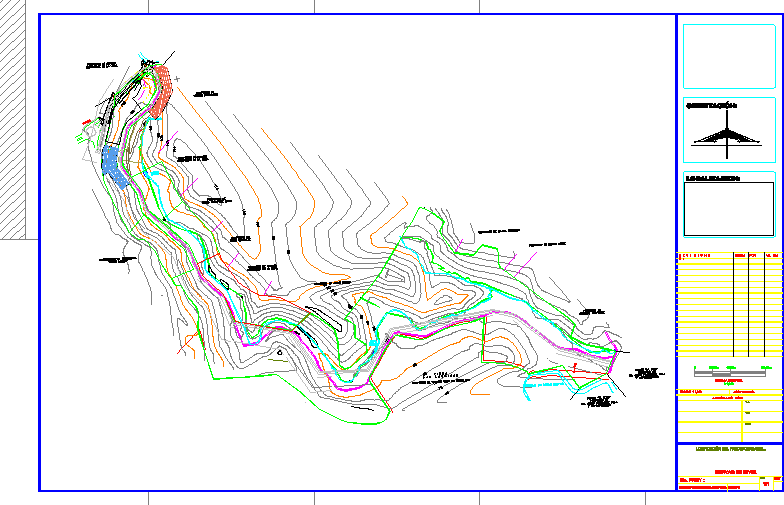
Contour lines of an area of ??30 hectares.
Drawing labels, details, and other text information extracted from the CAD file (Translated from Spanish):
black water stream, spring, dam, catchment, telmex pole, chain, concrete cut, boundary, existing top, telmex, tree, maya, property of augusto rodriguez, property of efrain gomez, fincalaslagrimas owned by yolanda gout de rebolledo , property of Samuel Murrieta, property of Jorge Galvez, property of Genaro Hernandez de la Mora, property of Edith Gonzalez, property of Daniel Gonzalez May, property of Vicente Reducindo, area of donation, state, municipality, old, mesh, green area, private property, lotification, approved by, no. proy.:, rev., place: coatzacoalcos, ver., lotification of the cartabio estate,., vo. bo :, checked :, graphic scale, orientation :, contours, date :, plane :, location :, acot. in: mts., r e v i s i o n s:, by :, vo. bo .:
Raw text data extracted from CAD file:
| Language | Spanish |
| Drawing Type | Block |
| Category | Handbooks & Manuals |
| Additional Screenshots |
 |
| File Type | dwg |
| Materials | Concrete, Other |
| Measurement Units | Metric |
| Footprint Area | |
| Building Features | |
| Tags | area, autocad, block, contour, DWG, lines |


