Contours Of Lambayeque DWG Block for AutoCAD
ADVERTISEMENT

ADVERTISEMENT
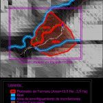
Planimetries – Contours
Drawing labels, details, and other text information extracted from the CAD file (Translated from Spanish):
buffer zone, proposed terrain, legend: rivers, flood damping area, truck trail, contour lines
Raw text data extracted from CAD file:
| Language | Spanish |
| Drawing Type | Block |
| Category | Handbooks & Manuals |
| Additional Screenshots |
 |
| File Type | dwg |
| Materials | Other |
| Measurement Units | Metric |
| Footprint Area | |
| Building Features | |
| Tags | autocad, block, contours, DWG, lambayeque, planimetries |


