Department Of Ica DWG Block for AutoCAD
ADVERTISEMENT
ADVERTISEMENT
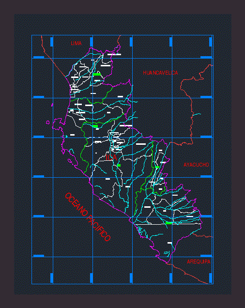
Plano georeferenced of Ica; WGS – 84; It contains provinces; districts; rivers; etc.
Drawing labels, details, and other text information extracted from the CAD file (Translated from Spanish):
ica, the village, ocucaje, pachacutec, parcona, new town, rooms, san jose de los mills, san juan bautista, santiago, subtanjalla, tate, yauca del rosario, high chincha, high laran, chavin, low chincha, el carmen, grocio meadow, san juan de yanac, san pedro de huacarpana, sunampe, tambo de mora, nazca, changuillo, ingenio, marcona, joyful view, palpa, llipata, rio grande, santa cruz, tibillo, pisco, huancano, humay, independence , paracas, san andres, san clemente, tupac amaru inca, chincha, pacific ocean, huancavelica, lima, ayacucho, arequipa
Raw text data extracted from CAD file:
| Language | Spanish |
| Drawing Type | Block |
| Category | Handbooks & Manuals |
| Additional Screenshots |
 |
| File Type | dwg |
| Materials | Other |
| Measurement Units | Metric |
| Footprint Area | |
| Building Features | |
| Tags | autocad, block, department, districts, DWG, georeferenced, ica, plano, provinces, rivers |
Related Products


Same Contributor

Featured Products


