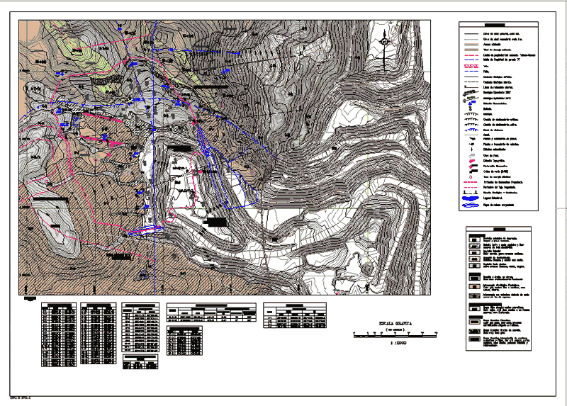
Geological Map Of Mine DWG Block for AutoCAD

Plano Geological Mina
Drawing labels, details, and other text information extracted from the CAD file (Translated from Spanish):
graphic scale, file cad:, elevation, bse-r, rt, coluvial deposit., q-fg, q-de, n-vr, n-to-da, q-cv, point, east, north, box of pits , plant, station, coordinates, geomechanical stations, sounding, diamond perforations, line, beginning, seismic lines, end, depth, dmt, ps-mi, q-bo, symbology, inferred lithological contact, defined lithological contact, heading and dipping of joints, existing access, geomechanical station, projected disassembling perimeter, course and dip of strata, topographical station, escarpment, old slip scar, active slip scar, diatreme edge, geological section – geotechnical., vein., failure., pit, seismic refraction line., seasonal lagoon., diamond drilling., canal., perimeter of the projected pit., legend, quaternary, anthropic deposit of dismount., bofedal, peat and organic soil and silt, colluvial deposit, sliding deposit., fluv reservoir io glaciar., neógeno, agglomerated pyroclastic rumiallana., Permian sup. Triassic inf., group mitu: quartzite conglomerates., Devonian, agglomerate with thin soil cover, excelsior group: quartzite gap., excelsior group: sandstone intercalation, quartzitic and phyllite, dark gray chlorine, parts, excelsior group: quartzite. , dipping, drilling data direction, peck cone, peck cones box, existing drainage tunnel, sandy loams and gravel, sandy low plasticity., brown color, clay clayey gravel., gravelly gravel sandy, dense, wet., gray color, fine texture to medium, rock, soft, massive., reddish color, massive hard rock or in banks, quartic, blocks and edges with clay., coarse, fracture., light gray color , very hard, presents, thin to medium stratification, very hard gray rock, argillic, soft rock, presents foliation and, brecciation, tonalite to dacite, in domes, moderately fractured hard rock, cutting waves, buttress , stabilization, tower of electric power, subvertical strata, compacted fill dam, property limit of the volcan-rancas agreement
Raw text data extracted from CAD file:
| Language | Spanish |
| Drawing Type | Block |
| Category | Handbooks & Manuals |
| Additional Screenshots |
 |
| File Type | dwg |
| Materials | Plastic, Other |
| Measurement Units | Metric |
| Footprint Area | |
| Building Features | |
| Tags | autocad, block, DWG, geology, map, plano |


