Hidrograica Plane Basin DWG Block for AutoCAD
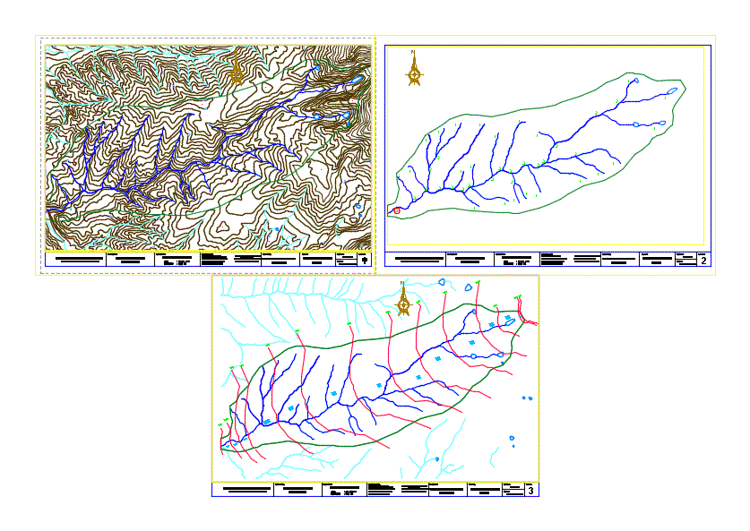
Topographical and surface lines
Drawing labels, details, and other text information extracted from the CAD file (Translated from Spanish):
national university of santa, faculty of engineering, professional school of civil engineering, project:, road map of third class, sheet:, scale :, student:, drawing :, teacher :, recuay, ancash, dept :, prov :, catac, roads, date :, course :, dist:, topographical, plane:, curves at level, emily sánchez vidal, sub areas, catholic university of chimbote, professional school of ing. civil, project:, hydrographic basin, river majes, location: valley of majes – arequipa, members: castle vega cesar, rodriguez vasquez rosli, evangelist jacinto edgar, carahuatay peña fisher, cordova parreño jeerlis, teacher :, ing. rigoberto cerna chavez, hydrology, plane :, plant, sheet :, scale :, date :, area, perimeter, rafaile lara jennifer, rodriguez vasquez roslin, roncal ascate junior, saldaña cortez eduardo
Raw text data extracted from CAD file:
| Language | Spanish |
| Drawing Type | Block |
| Category | Handbooks & Manuals |
| Additional Screenshots |
 |
| File Type | dwg |
| Materials | Other |
| Measurement Units | Metric |
| Footprint Area | |
| Building Features | |
| Tags | autocad, basin, block, DWG, hydrology, lines, plane, surface, topographical |
Related Products


Same Contributor


Featured Products


