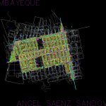
Lambayeque – Peru DWG Block for AutoCAD

Plano Lambayeque cut apart; Peru. Georeferenced.
Drawing labels, details, and other text information extracted from the CAD file (Translated from Spanish):
the tumi, viru, born, ca. wiracocha, market, ca. viru, antisuyo, inti raymi, the tambos, av. empire, capac yupanqui, av. fraternity, av. mayta capac, collasuyo, av. the Incas, av. inti raymi, ca. the tumi, ca. the platforms, ca. Manco Inca, ca. Inca Rock, Yahuarhuaca, Wiracocha, Inca Yupanqui, Manco Inca, Andenes, Av. the andes, av. the quipus, ca. amaru inca yupanqui, ca. yahuarhuaca, ca. empire, av. the ñustas, av. the amautas, the minga, av. union, ayar, municipality, ama sua, paramonga, passage, psje. Santa Isabel, Park, Paracas, CA. the quipus, ca. Chavin, the ayllu, ca. the ayllu, c. to. Salaverry, c.e., ca. paramonga, zonal, ca. cahuide, ca. the legends, mitimaes, ca. tiahuanaco, psje. Miguel Grau, sta. Isabella, ca. the mitimaes, ca. fraternity, ca. the miracle, av. Miguel Grau, ca. Rune simi, la colla, xii, xiii, xiv, xvi, xvii, xviii, xix, ca. platforms, ca. inca yupanqui, angel saenz sandoval, lambayeque
Raw text data extracted from CAD file:
| Language | Spanish |
| Drawing Type | Block |
| Category | Handbooks & Manuals |
| Additional Screenshots |
 |
| File Type | dwg |
| Materials | Other |
| Measurement Units | Metric |
| Footprint Area | |
| Building Features | Garden / Park |
| Tags | autocad, block, Cut, DWG, georeferenced, lambayeque, PERU, plano |


