Lotificacion And Analysis Delsitio DWG Block for AutoCAD

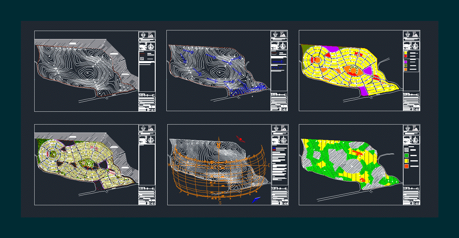
SUBDIVISION IN Jalapa veracuz – LOTIFICACION – TOPOGRAPHIC MAP – PERCENTAGE OF PENDING – WATER RESOURCE – ZONING
Drawing labels, details, and other text information extracted from the CAD file (Translated from Spanish):
May, April, Tues., Feb., Jan., Nov., Oct., Sep., Aug., Jul., Jun., xii, viii, iii, location :, dimension :, scale :, plane :, type of plane :, matter :, veracruzana university, faculty of architecture, graphic scale :, mts, members :, simbology :, pending, urban design workshop, analysis of pending, aguilar ruiz uriel, angel escutia ruben, toribio zepeda xavier, candle jahir, garcia rivera sandra, lotification, sun and winds, prevailing winds, strong winds, coordinates :, temperature range :, precipitation range :, weather :, abundant rains in summer, rains all year round, rains in, source :, geographical information directory, municipal of the united states mexicans, xalapa veracruz, zoning, housing, high density, topographic, level curves are to, master curves., boundary, level curve, nature park , adjoining, private land, av.arco south, avenue south arc, colony lomas, green, xalapa veracruz., adjoining, access, hydrology, giipi, direction arrow runoff, rainwater, crosses indicating the area of possible , flood inside the property
Raw text data extracted from CAD file:
| Language | Spanish |
| Drawing Type | Block |
| Category | City Plans |
| Additional Screenshots |
 |
| File Type | dwg |
| Materials | Other |
| Measurement Units | Metric |
| Footprint Area | |
| Building Features | Garden / Park |
| Tags | analysis, autocad, beabsicht, block, borough level, DWG, fractionation, land, lotificacion, map, pending, political map, politische landkarte, proposed urban, road design, stadtplanung, straßenplanung, subdivision, topographic, urban design, urban plan, veracruz, water, zoning |


