Lotificacion DWG Block for AutoCAD

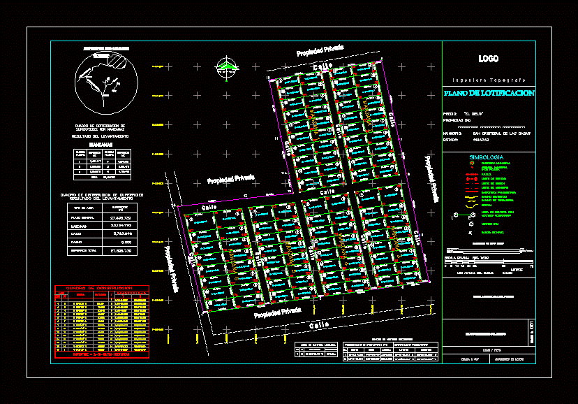
MAP LOTIFICACION
Drawing labels, details, and other text information extracted from the CAD file (Translated from Spanish):
north, type of area, general plan, blocks, streets, road, total surface, surface distribution box resulting from the survey, or police, covered road, dirt road, gap, paved road, municipality limit, region limit , state limit, ffcc, symbology, municipal agency, municipal head, engineer-pointer, project no., place and date, graphic scale, meters, dimensions in meters, current land use: baldio, vertice utm, survey by direct method, signature authorized from the expert, to tuxtla gutierrez, to san lucas- chiapilla, cruise, control line with, geodesic vertices, north, astronomical direction, horizontal distance, level bench, to reedbed, construction block, side, coordinates, distance, course , est, apple, number, surface, total, logo, general data of the expert
Raw text data extracted from CAD file:
| Language | Spanish |
| Drawing Type | Block |
| Category | Handbooks & Manuals |
| Additional Screenshots |
 |
| File Type | dwg |
| Materials | Other |
| Measurement Units | Metric |
| Footprint Area | |
| Building Features | |
| Tags | autocad, block, DWG, lotificacion, map |


