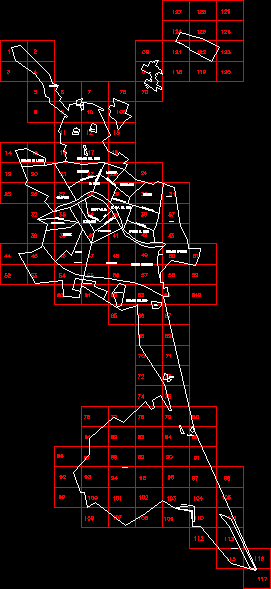
Map General Plan Valencia, Spain – – P G O U Index DWG Plan for AutoCAD
ADVERTISEMENT

ADVERTISEMENT
Plan General de Ordenacion Urbana, the Spanish government’s uniform urban land use application, for Valencia
Drawing labels, details, and other text information extracted from the CAD file (Translated from Catalan):
the peephole, the gulls, the saler, pinedo, alcance oven, san marcelino, fountain of san luis, four races, Nazareth, Jesus, patraix, the olivereta, extrawalls, the widening one, bell tower, benicalap, scratch, benimaclet, algires, old City, towns of the west, maritime towns, towns of the south, harbor avenue, Blasco ibañez avenue, cabbage, malvarrosa, roads to the degree, she said, psest aleixandre avenue, reial primate avenue, avenue of the constitution, colon, guillem de castro, gv brands of turia, the plan of the real, towns of the north, borboto, carpesa, goodbye, massarroches, the lagoon, the palmar, Avenida del Cid
Raw text data extracted from CAD file:
| Language | N/A |
| Drawing Type | Plan |
| Category | City Plans |
| Additional Screenshots |
 |
| File Type | dwg |
| Materials | |
| Measurement Units | |
| Footprint Area | |
| Building Features | Car Parking Lot |
| Tags | autocad, beabsicht, borough level, de, DWG, general, government, index, land, map, plan, political map, politische landkarte, proposed urban, road design, spain, spanish, stadtplanung, straßenplanung, urban, urban design, urban plan, urbana, valencia, zoning |


