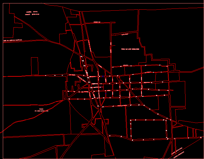
Map Mexicaltzingo; MÉXico DWG Block for AutoCAD
ADVERTISEMENT
ADVERTISEMENT
Map Mexicaltzingo; México State. Include roads;directions; main streets names ; actualized widths of roads
Drawing labels, details, and other text information extracted from the CAD file (Translated from Spanish):
nicolas bravo, metepec municipality, mexicaltzingo municipality, ejido san bartolome tlaltelulco, town, san mateo mexicaltzingo, josefa ortiz de dominguez, Warrior, insurgents, dominguez, j. or. from, beyond, aldama, independence, February, gentleman, leon guzman, cuahutemoc, Toluca, j. or. from dominguez, aldama, Benito Juarez, pavement of the pantheon, francisco villa, emiliano, shoe, venustian, mexicaltzingo municipality, municipality chapultepec, san mateo mexicaltzingo town, mine, carranza, illustrious, mens, insurgents, independence, carranza, h. illustrious, felipe estrada, revolution, daffodil, mendoza, mexicalcingo
Raw text data extracted from CAD file:
| Language | Spanish |
| Drawing Type | Block |
| Category | City Plans |
| Additional Screenshots |
 |
| File Type | dwg |
| Materials | |
| Measurement Units | |
| Footprint Area | |
| Building Features | Car Parking Lot |
| Tags | autocad, beabsicht, block, borough level, DWG, include, main, map, municipality, names, political map, politische landkarte, proposed urban, road design, stadtplanung, state, straßenplanung, street, streets, urban design, urban plan, xico, zoning |
Related Products

Same Contributor


Featured Products


