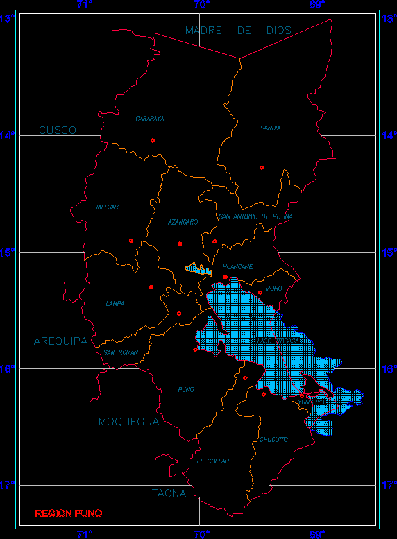
Map Puno Region Provinces, Peru DWG Block for AutoCAD
ADVERTISEMENT
ADVERTISEMENT
Map of the Puno Region and its 13 Provinces
Drawing labels, details, and other text information extracted from the CAD file (Translated from Spanish):
Puno region, Madre de Dios, Cusco, Arequipa, Moquegua, Tacna, Collao, Chucuito, Yunguyo, Puno, San Roman, Lampa, Huancane, Mold, Azangaro, Melgar, San Antonio de Putina, Watermelon, Carabaya, Lake Titicaca
Raw text data extracted from CAD file:
| Language | Spanish |
| Drawing Type | Block |
| Category | Handbooks & Manuals |
| Additional Screenshots |
 |
| File Type | dwg |
| Materials | Other |
| Measurement Units | Metric |
| Footprint Area | |
| Building Features | |
| Tags | autocad, block, DWG, map, PERU, provinces, puno, region |
Related Products


Same Contributor


Featured Products


