Map Transport System Coacalco – Mexico State DWG Block for AutoCAD
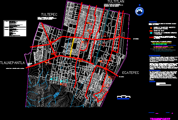
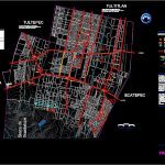
Map of main line of transport in Coacalco – Mexico State
Drawing labels, details, and other text information extracted from the CAD file (Translated from Spanish):
sierra de guadalupe, symbology:, conclusions, dimension, scale, transport, graphic scale:, observations, source, living place, secretariat of urban development, government of the state of mexico, collective transportation bases, bases of the collective transport system within the municipality., taxi bases, whereabouts of foreign urban buses, the existing public passenger transport system presents an estimated coverage of the per capita, mainly comprising the urban area located to the north and south of the josé lópez route, with data on these main routes as the flow of collective transportation units per minute. counting the flow of units coming from bases as martin green Indians that at times do not go directly inside the municipality but only all this influences to a great extent with the problems also covering a significant percentage of the transportation to the interior of using the main avenues., urban development plan of coacalco, the areas not covered by the service per cent have the following characteristics: the industrial zone located to the east of the limits with which the carriers have established their routes through the main roads that do not meet with cause problems of saturation of the road system due to the constant ascents descents of passengers., flow of collective transport units buses from stops outside the municipality, via morelos, gustavo baz, flow of collective transport units buses from stops outside the municipality, ecatepec, tultitlan, tultepec, tlalnepantla, of June meadows cuatitlan sources of valley perinorte, moctezuma heroes coacalco, new millennium villa of flowers moctezuma, Coyote heroes, indian bartolo meadows, mexico from san jose, indians villa of flowers, mexico tultepec indians tultepec, metro moctezuma villa de las heroes coacalco, the green sn rafael meadows units, main public transport routes, av la lagoa
Raw text data extracted from CAD file:
| Language | Spanish |
| Drawing Type | Block |
| Category | City Plans |
| Additional Screenshots |
 |
| File Type | dwg |
| Materials | N/A |
| Measurement Units | |
| Footprint Area | |
| Building Features | Car Parking Lot |
| Tags | autocad, beabsicht, block, borough level, DWG, line, main, map, mexico, political map, politische landkarte, proposed urban, road design, stadtplanung, state, straßenplanung, system, transport, urban design, urban plan, zoning |


