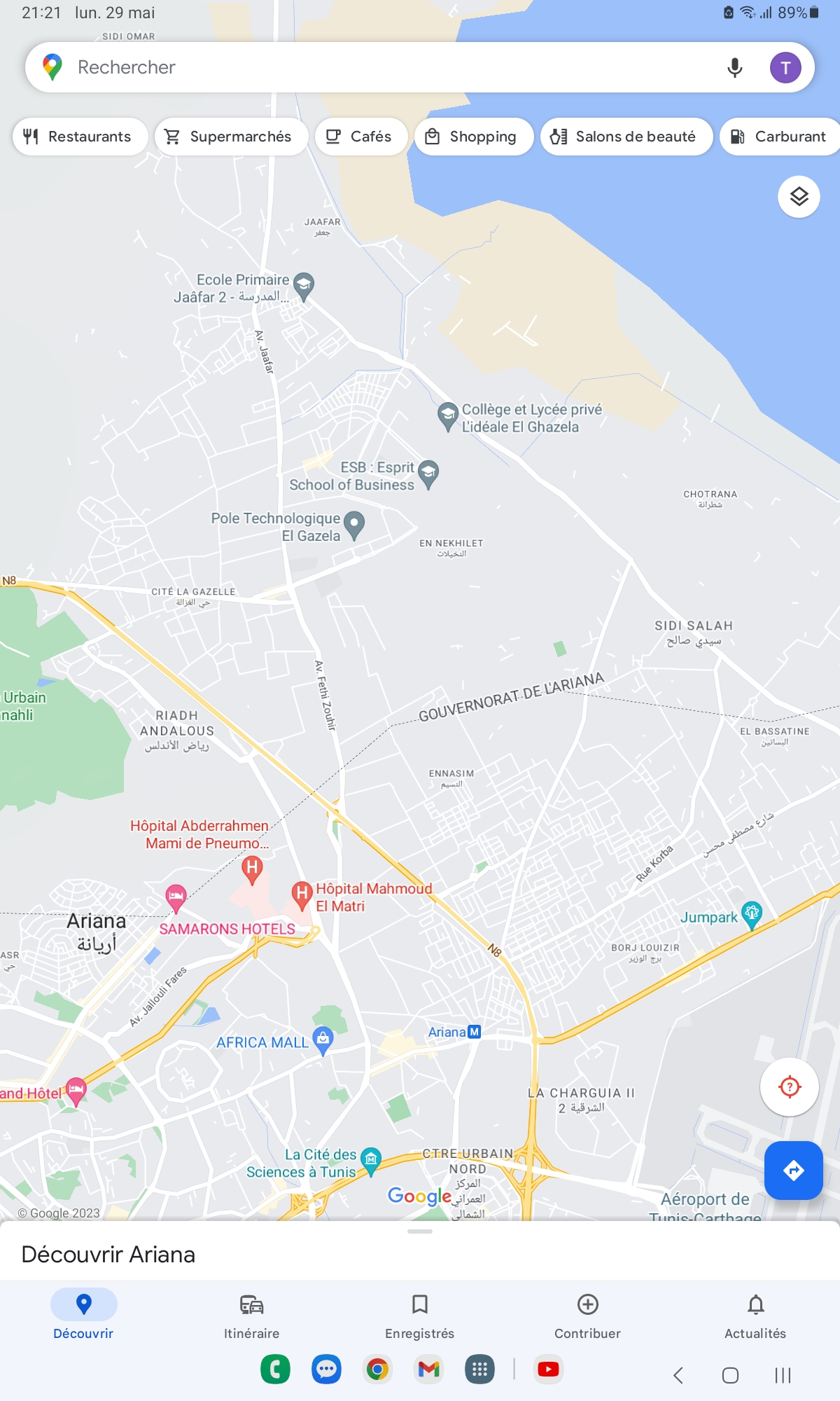
Map Uraca Corire District, Castilla, Arequipa, Peru DWG Block for AutoCAD

Full map of Corire belonging to the District Centre Uraca in Castilla – Arequipa – PERU
Drawing labels, details, and other text information extracted from the CAD file (Translated from Spanish):
income is arranged, accommodate, subdiv, servitude, judgment, probab, judgment, inscr, north of grid, income is arranged, accommodate, subdiv, servitude, judgment, probab, judgment, inscr, farmland, human settlement, Ramón Zegarra, farmland, sports area, education, small industry, avenue, avenue juan pablo vizcardo guzman, street mariscal cáceres, passage jose olaya, street square of july, Related searches, street mariscal cáceres, san martín de porres avenue, passage the jasmines, avenue ramón castilla, street josé carlos mariátegui, passage, avenue progress, Related searches, street square of july, street mariscal cáceres, avenue juan pablo vizcardo guzman, pass the laurels, road application, passage, Street, sporty, others, Finnish, human settlement, fifth channels, farmland, property, third-party, farmland, owned by third parties, farmland, see detail, servitude, road application, passage, mz., lot, area, mz., lot, area, other purposes, area, common area, of lots, common area, see detail, avenue juan pablo vizcardo guzman, passage jose olaya, servitude, detail, avenue ramón castilla, avenue, progress, esc:, area, dominant lot, batch servant, common area, of lots, common area apple lot, area, scale, education, common area, scale, technical area, province, district, Castile, arequipa, Department, populated center, plane number, building code, flat, sheet number, uraca, archive, edition:, date:, modification of the, layout, corire, other purposes
Raw text data extracted from CAD file:
| Language | Spanish |
| Drawing Type | Block |
| Category | City Plans |
| Additional Screenshots |
 |
| File Type | dwg |
| Materials | Other |
| Measurement Units | |
| Footprint Area | |
| Building Features | Car Parking Lot |
| Tags | arequipa, autocad, beabsicht, belonging, block, borough level, castilla, centre, district, DWG, full, map, PERU, political map, politische landkarte, proposed urban, road design, stadtplanung, straßenplanung, urban design, urban plan, zoning |
Related Products

Same Contributor


Featured Products


