Maracaibo -Plane Zoning DWG Block for AutoCAD
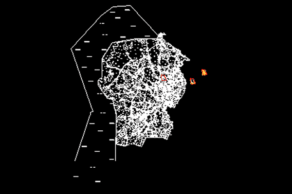
Plane zoning Maracaibo – Zulia State – Venezuela. year 2005
Drawing labels, details, and other text information extracted from the CAD file (Translated from Spanish):
mayoralty of, maracaibo, plate :, date :, scale :, local urban development plan of maracaibo, prp – planned residential polygon, bolivarian republic of venezuela, zulia state, municipality of maracaibo municipality, local urban development plan of maracaibo – pdum , zoning plan of the city of maracaibo, general zoning, north, graphic scale :, ndr – new residential developments, pcr – recreational coastal polygon, cv – neighborhood trade, cvm – neighborhood trade metro, sic – coastal industrial service, cc – communal trade, ccm – communal trade metro, si – industrial services, sim – industrial service metro, ac – conservation areas, zi – industrial zone, pa – welfare polygon, pe – educational polygon, pcb – neighborhood consolidation polygon, psc – socio cultural polygon, pag – governmental administrative polygon, cr – recreational trade, only for review of the municipal chamber, api – infrastructural protection areas a, prd – sports recreational polygon, ucm – complementary use metro, zp – protective zone, sim, api, ucm, eum, ccm, cvm, pcb-cc, prp-cc, protective zone, prp, ndr, prp-cc, prp-cv, ndr-cv, pag, pcb, pcb-cv, pcr, prd, psc, pe light, sic-cr, pcb- cv, prp- cv, pag-cv, fields, local urban development plan maracaibo pdum, zoning plan
Raw text data extracted from CAD file:
| Language | Spanish |
| Drawing Type | Block |
| Category | Handbooks & Manuals |
| Additional Screenshots |
 |
| File Type | dwg |
| Materials | Other |
| Measurement Units | Metric |
| Footprint Area | |
| Building Features | |
| Tags | autocad, block, DWG, maracaibo, plane, state, Venezuela, year, zoning, zulia |


