Old Map Of Panama With Land Use Rules DWG Block for AutoCAD
ADVERTISEMENT

ADVERTISEMENT
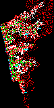
Map of Panama Viejo town (San Felipe and Chorrillo) with land use rules. Includes legend
Drawing labels, details, and other text information extracted from the CAD file (Translated from Spanish):
rm residential median residential density median commercial density residential commercial density commercial historical siv institutional siv institutional park
Raw text data extracted from CAD file:
| Language | Spanish |
| Drawing Type | Block |
| Category | City Plans |
| Additional Screenshots |
 |
| File Type | dwg |
| Materials | |
| Measurement Units | |
| Footprint Area | |
| Building Features | Garden / Park |
| Tags | autocad, beabsicht, block, borough level, DWG, felipe, includes, land, map, panama, political map, politische landkarte, proposed urban, road design, rules, san, stadtplanung, straßenplanung, town, urban design, urban plan, zoning |
Related Products

Same Contributor

Featured Products