Plane Maracaibo – Venezuela DWG Model for AutoCAD
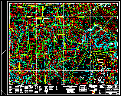
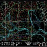
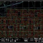
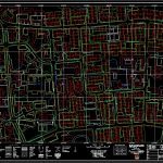
Planes of Maracaibo city by quadrants.To unify all the models . a new file should open up and insert each file in the insert bench mark 0;0;0, This is quadrant
Drawing labels, details, and other text information extracted from the CAD file (Translated from Spanish):
retaining wall, cut, embankment, defending, pipeline, Gas pipeline, aqueduct, Electric lines, Towers posts, freeway, highway, Geared road, Path, railway, bridge, Hedge, Wall Wall, tunnel, ravine, channel, lagoon, pool, forest, culture, sand, Flooded ground, rock, Building house, building, demolition, sewer, sink, Mouth of visit, Contour lines, depression, River, Alc, Triangulation vertex, Polygonal vertex, B. M., Level level, Photographic quota, Erographies, scale, Level curves intervals of meters, Reduced distance mean level meters, Altimetric datum mean sea level, Flat rectangular projection, coordinates origin, Cathedral of maracaibo, Meters, Index of placement of the leaves, Using photogra-, made by, Maracaibo consortium, Mission Scale Aircraft, Dated February, Stereo c., From venezuela c.a., This letter was elaborated with methods, Leaf no, Aerial photogrammetric survey, City of maracaibo, town hall, Maracaibo, date:, scale, urban, Approve, Dib., Rev., Proy., Calc., ministry, of the, development, S.a., Total leaves, Zulia state, Ref., series, total, center, Rafael, Urdaneta, Autoplott c.a., Digital maps produced by, loyal, Very noble, The pomona, Street the fortress, Street, avenue, The pomona, retaining wall, cut, embankment, defending, pipeline, Gas pipeline, aqueduct, Electric lines, Towers posts, freeway, highway, Geared road, Path, railway, bridge, Hedge, Wall Wall, tunnel, ravine, channel, lagoon, pool, forest, culture, sand, Flooded ground, rock, Building house, building, demolition, sewer, sink, Mouth of visit, Contour lines, depression, River, Alc, Triangulation vertex, Polygonal vertex, B. M., Level level, Photographic quota, Erographies, scale, Level curves intervals of meters, Reduced distance mean level meters, Altimetric datum mean sea level, Flat rectangular projection, coordinates origin, Cathedral of maracaibo, Meters, Index of placement of the leaves, Using photogra-, made by, Maracaibo consortium, Mission Scale Aircraft, Dated February, Stereo c., From venezuela c.a., This letter was elaborated with methods, Leaf no, Aerial photogrammetric survey, City of maracaibo, town hall, Maracaibo, date:, scale, urban, Approve, Dib., Rev., Proy., Calc., ministry, of the, development, S.a., Total leaves, Zulia state, Ref., series, total, center, Rafael, Urdaneta, Autoplott c.a., Digital maps produced by, loyal, Very noble, Street, avenue, Street, Susi alley, Street, avenue, Street, saint, Luis, Street, av., Street, avenue, Street, avenue, Progress, Santa ana street, retaining wall, cut, embankment, defending, pipeline, Gas pipeline, aqueduct, Electric lines, Towers posts, freeway, highway, Geared road, Path, railway, bridge, Hedge, Wall Wall, tunnel, ravine, channel, lagoon, pool, forest, culture, sand, Flooded ground, rock, Building house, building, demolition, sewer, sink, Mouth of visit, Contour lines, depression, River, Alc, Triangulation vertex, Polygonal vertex, B. M., Level level, Photographic quota, Erographies, scale, Level curves intervals of meters, Reduced distance mean level meters, Altimetric datum mean sea level, Flat rectangular projection, coordinates origin, Cathedral of maracaibo, Meters, Index of placement of the leaves, Using photogra-, made by, Maracaibo consortium, Mission Scale Aircraft, Dated February, Stereo c., From venezuela c.a., This letter was elaborated with methods, Leaf no, Aerial photogrammetric survey, City of maracaibo, town hall, Maracaibo, date:, scale, urban, Approve, Dib., Rev., Proy., Calc., ministry, of the, development, S.a., Total leaves, Zulia state, Ref., series, total, center, Rafael, Urdaneta, Autoplott c.a., Digital maps produced by, loyal, Very noble, Cjn, Santa, Martha, Santa ana alley, avenue, avenue, Street, Electric sub station, retaining wall, cut, embankment, defending, pipeline, Gas pipeline, aqueduct, Electric lines, Towers posts, freeway, highway, Geared road, Path, railway, bridge, Hedge, Wall Wall, tunnel, ravine, channel, lagoon, pool, forest, culture, sand, Flooded ground, rock, Building house, building, demolition, sewer, sink, Mouth of visit, Contour lines, depression, River, Alc, Triangulation vertex, Polygonal vertex, B. M., Level level, Photographic quota, Erographies, scale, Level curves intervals of meters, Reduced distance mean level meters, Altimetric datum mean sea level, Flat rectangular projection, coordinates origin, Cathedral of maracaibo, Meters, Index of placement of the leaves, Sterofotogrametricos ut
Raw text data extracted from CAD file:
| Language | Spanish |
| Drawing Type | Model |
| Category | City Plans |
| Additional Screenshots |
           |
| File Type | dwg |
| Materials | |
| Measurement Units | |
| Footprint Area | |
| Building Features | Pool, Car Parking Lot |
| Tags | autocad, beabsicht, borough level, city, DWG, file, insert, maracaibo, model, models, open, plane, PLANES, political map, politische landkarte, proposed urban, quadrants, road design, stadtplanung, straßenplanung, urban design, urban plan, Venezuela, zoning |


