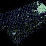
Plano City Of Colon, Entre RÍOs, Argentina DWG Block for AutoCAD
ADVERTISEMENT

ADVERTISEMENT
Cadastral map of the City of Colon – Enre Ríos Province, Argentina. With the urban and municipal lands – are apples and plots with their designations, streets, concessions, National Route 14, Ruta Provincial N º 135 to the International Bridge Artigas (Columbus – Paysandu)
Raw text data extracted from CAD file:
| Language | N/A |
| Drawing Type | Block |
| Category | City Plans |
| Additional Screenshots |
 |
| File Type | dwg |
| Materials | |
| Measurement Units | |
| Footprint Area | |
| Building Features | Car Parking Lot |
| Tags | argentina, autocad, beabsicht, block, borough level, cadastral, city, colon, DWG, entre, map, municipal, plano, political map, politische landkarte, proposed urban, province, road design, stadtplanung, straßenplanung, urban, urban design, urban plan, zoning |


