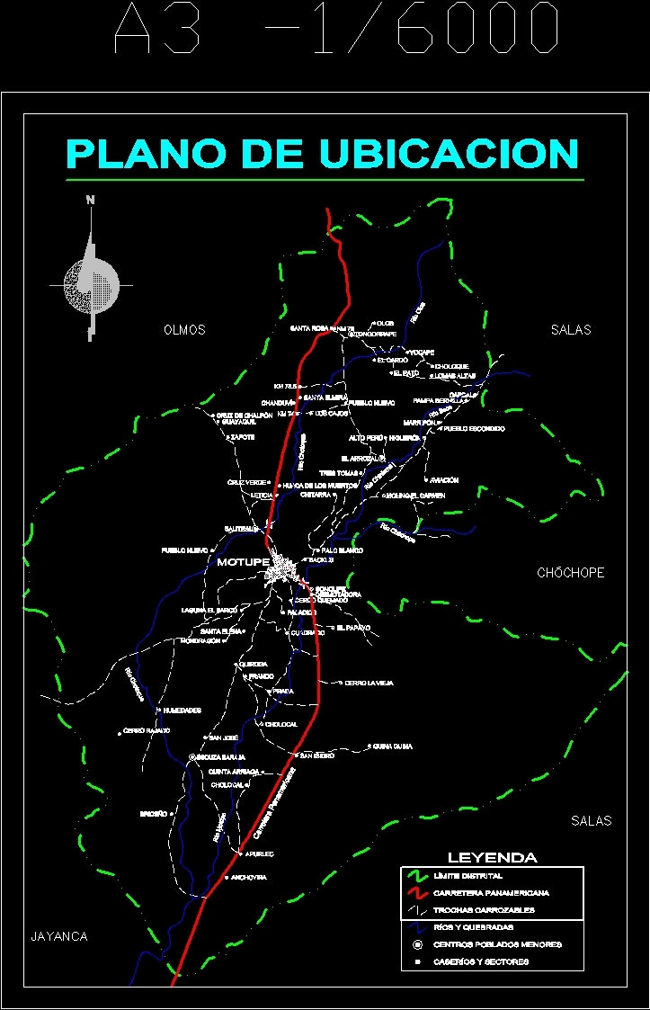
Plano Location Motupe Hamlet Hamlet DWG Block for AutoCAD

Plano of location of Motupe; Lambayeque;
Drawing labels, details, and other text information extracted from the CAD file (Translated from Spanish):
location map, district boundary, legend, Panamerican’s highway, carvings, broken rivers, country houses, smaller towns, the papaya, scissors shuffle, cholocal, apurlec, anchovy, briceño, Saint Joseph, broken hill, humidities, cholocal, San Isidro, quiroga, Frank, prada, mondragon, st. Helen, square, palaces, burned siege, the sarco pond, I closed the old one, new town, motupe, sonolipe, backus, White stick, mill the carmen, salitral, the rice field, marripon, aviation, fig tree, hidden town, pampa bernilla, cardinal, high peru, chitarra, Leticia, huaca de los muertos, green Cross, sapodilla, Guayaquil, chalpondle cross, tongorrape, santa elmira, the curls, new town, Saint Rose, them, the thistle, the duck, yocape, farm, high hills, elms, rooms, chateau, rooms, jayanca, Panamerican’s highway, chotoque river, motorboat river, chateau river, river chiniama, river olos, dry river, three shots, chanduví, chotoque river, quinine, gin, quinta arriaga
Raw text data extracted from CAD file:
| Language | Spanish |
| Drawing Type | Block |
| Category | City Plans |
| Additional Screenshots |
 |
| File Type | dwg |
| Materials | |
| Measurement Units | |
| Footprint Area | |
| Building Features | Car Parking Lot |
| Tags | autocad, beabsicht, block, borough level, DWG, lambayeque, location, PERU, plano, political map, politische landkarte, proposed urban, road design, stadtplanung, straßenplanung, urban design, urban plan, zoning |
Related Products

Same Contributor
Featured Products


