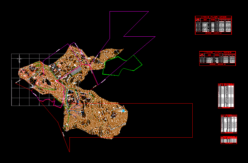
Surveying Mina DWG Block for AutoCAD

Location and polygon of a property intended for mining fine
Drawing labels, details, and other text information extracted from the CAD file (Translated from Spanish):
const, cab, cbloqe, pat, reserv, enter, fcun, bcun, tub, trf, chime, wall, antenna, box, alc, zrefores, house, tnqe, nursery, gavi, entrance, court, kiosk, monument, staircase, mur, bascula, carcamo, gavion, ecan, fincun, fincu, ucun, caj, zaranda, pati, cresv, resv, construction, warehouse, gully, front, mix flower, stoneware, patio, mix, mix clay, stoneware, ovens, chimney, cellar, bathrooms, dump, clay, recovered, bunch, coffee, grain, orita, ponelana, patio, ponelana, patio mixtures, proposal, yellow, red, pantoja, tube, descapote, patio, indumil, arenizca, load mix, red mixture of, blue clay, consumption, blue, ditch, plant, pantoja, level, discipator, reservoir, side, coordinates, distance, bearing, est, coordinates: plantation location, scale :, elaborated: , reviewed :, drew :, scale :, file :, date :, origin :, plane :, julia nosia, alpha gres sa, dwg, thematic conventions, polygon stoneware, limit pantoja, e dificaciones, access routes, general conventions, ing. sonia juliana nossa, village: pantoja municipality: soacha. department: cundinamarca, source: polygon plantation forest
Raw text data extracted from CAD file:
| Language | Spanish |
| Drawing Type | Block |
| Category | Handbooks & Manuals |
| Additional Screenshots |
 |
| File Type | dwg |
| Materials | Other |
| Measurement Units | Metric |
| Footprint Area | |
| Building Features | Deck / Patio |
| Tags | autocad, block, DWG, fine, intended, location, mining, polygon, property, surveying |


