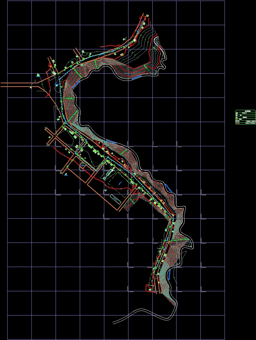
Topographical Plane DWG Block for AutoCAD

TOPOGRAPHICAL PLANE WITH COORDINATES UTM WGS 84 – INSTALLATION OF WATER NETWORKS AND DRAIN
Drawing labels, details, and other text information extracted from the CAD file (Translated from Spanish):
provincial municipality of colonel portillo, sub management of studies and projects, project :, location :, reg., prov., dist., loc., lamina :, specialty :, plan :, provincial mayor :, sr. second perez collazos, designer:, drawing :, date :, scale :, topographical plant, topography, infrastructure and works management, manager of intraestructura and works :, sub manager of studies and projects :, ing. jesus masias estacio bazan, date, ing. lenin s. marquez visag, post bt, station, tree, existing dwellings, property limit, section iii, section ii, street, house, boundary, bajial, church, school, mirror_water, field, esq, tank, sshh, limit, pt_mad, limit , latrines, ramada, ansena_gilat, posta, septic, well, pit, pool, local, garden, field, church, esq_mz, n.max.agua, ref, polygonal open, gully masaray, consultant:, section i
Raw text data extracted from CAD file:
| Language | Spanish |
| Drawing Type | Block |
| Category | Handbooks & Manuals |
| Additional Screenshots |
 |
| File Type | dwg |
| Materials | Other |
| Measurement Units | Metric |
| Footprint Area | |
| Building Features | Garden / Park, Pool |
| Tags | autocad, block, contours, coordinates, drain, DWG, installation, networks, plane, topographical, topography, utm, water |
Related Products


Same Contributor

Featured Products


