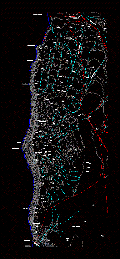
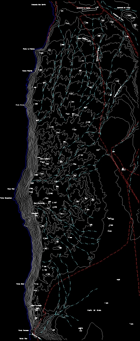
Topography Of Chile DWG Block for AutoCAD
ADVERTISEMENT
ADVERTISEMENT
Chile topografica coverage 50mil
Drawing labels, details, and other text information extracted from the CAD file (Translated from Spanish):
cove san martín, aerodrome the vulture, lobito, pampa de chaca, quebrada vitor, caleta vitor, punta thomson, cerro velazquez, punta ointo, gulch bad step, broken the jars, hill tecas, gulch of acha, gulch of azapa, punta la pigeon, rocks birds, white tip, solitary hill, camaraca hill, rock vitor, tip baquedano, camaraca
Raw text data extracted from CAD file:
| Language | Spanish |
| Drawing Type | Block |
| Category | Handbooks & Manuals |
| Additional Screenshots |
 |
| File Type | dwg |
| Materials | Other |
| Measurement Units | Metric |
| Footprint Area | |
| Building Features | |
| Tags | autocad, block, chile, coverage, DWG, topography |
Related Products


Same Contributor

Featured Products


