Urban Charter Comitan DWG Block for AutoCAD

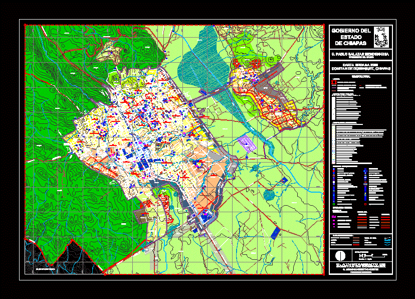
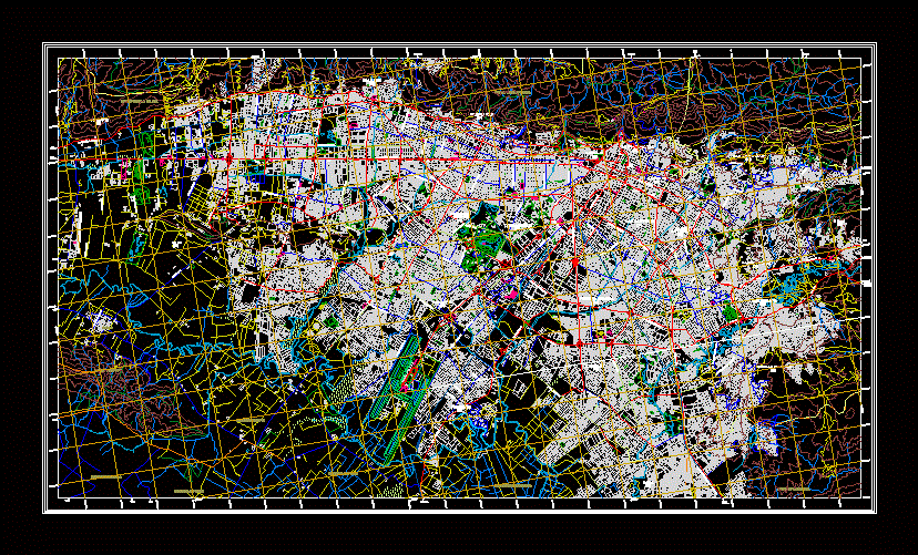
This urban letter is from the city of Comitan de Dominguez Chiapas – which contains the types of land uses among other things
Drawing labels, details, and other text information extracted from the CAD file (Translated from Spanish):
ru-mp_cr, au-up_mb, au-up_cc, ru-mp_cc, ru-lp_ip, ru-lp_il, ac-pe_ag, limit of the application area, comitan de dominguez, chiapas, h. municipality of, comitan de dominguez, simbology :, government of, state, of chiapas, c. pablo salazar mendiguchia, governor of the state, graphic scale, limits, limit of population center, primary zoning, classification of areas for the application of ordering policies, limit of the current urban area, limit of rural community, limit of historical center, protection limit to the physiognomy, areas of progressive urbanization, built-up urban areas, au-in, au-up, areas of protection to the historical heritage, ap-ph, urban protection areas, ap-pf, reserve areas short-term urban, ru-cp, medium-term urban reserve areas, ru-mp, long-term urban reserve areas, ru-lp, special facilities restriction areas, ri-rg, ecological heritage protection areas , ap-pe, areas of conservation of ecological heritage, ac-pe, areas of protection to waterways and bodies of water, ap-ca, secondary zoning, classification of land uses and destinations for the control of urbanization, areas of activities s ilvicolas, areas of agricultural activities, areas of commerce and services of neighborhood level, zones of commerce and services of district level, zones of commerce and services of central level, zones of commerce and services of regional level, zones of mixed uses, room, trade and services, light industry and low risk areas, medium and high risk industry zones, areas of institutional equipment, wild areas, green spaces, private management equipment areas, equipment destinations, library, education , house of culture or museum, social center, auditorium, temples, municipal presidency, gardens and squares, prison, fire station, public offices, archaeological site, health sector, family assistance and asylums, food and market center, cemetery, trail, canvas charro, sports courts, sports unit, fair facilities, taxi station, urban bus station, foreign bus station, central c amionera, gasoline, military installations, deep well, areas of infrastructure facilities, treatment plant, sewage, electric sub-station, tank, distribution or rebombeo, urban structure, local street, main road, regional roads, road collection , secondary, existent, proposed, garden of children, temple, primary, family assistance, mpal presidency, gasoline, secondary, museum, preparatory, unit, social center, auditorium, square and garden, house of culture, market, clinics, clinic, sports center, asylum, regional hospital, primary and TV antenna, medical unit, sports court, station, fire, school, archaeological zone, boarding school, or camp, hospital, technical, facilities, fair, garden children ,, primary, secondary, and preparatory, military, substation, electric, municipal cemetery, central, supplies, sport unit, sports stadium, superior, well tinajab, pozo rio grande, cerrit or conception, tank, tank the battery, tank the lion, san miguel, refueling tank, tank ofna. central, dominguez belisario, tank nehuentic, tanks, water purification tank, the twins, the chimis, well the cedar, tank h. quijá, tio ticho well, maquiladora plant, textile, ru-cp_cr, au-in_cc, ap-ph_mb, ap-ph_cc, ap-pf_cd, au-in_cd, au-up_cr, au-in_mb, ru-cp_cd, ru-cp_mb , ru-mp_mb, ap-pe_fo, au-in_cr, ap-pe_as, urban units, road system, urban center, urban sub-center, district center, neighborhood center, ap-ph_as, ap-ca_as, areas with extractive activity that require soil rehabilitation, san martin neighborhood, santa cecilia neighborhood, neighborhood of guadalupe, neighborhood the mirador, barrio cruz grande, barrio san miguel, barrio la pila, el calvario neighborhood, san agustin neighborhood, san sebastian neighborhood, downtown area, el cedro neighborhood , neighborhood san antonio, la pilita seca neighborhood, microwave neighborhood, san jose neighborhood, la sink district, nicalocock neighborhood, miguel aleman neighborhood, belisario dominguez neighborhood, n. ruiz, los sabinos neighborhood, yalchivol neighborhood, los desamparados neighborhood, military zone neighborhood, la candelaria neighborhood, las jacarandas neighborhood, la cueva neighborhood, nitre neighborhood, las flores neighborhood, hidalgo bridge neighborhood, chichima neighborhood, unach neighborhood – reclusorio, c . jorge constantino kanter, municipal president, restriction areas for infrastructure, ri-in, ri-rg_ee, special equipment zones, ri-in_in, at_cr, transition areas, av. tikal, street revolution, mayan street, prol. c. central pte., lic. benito juarez, pte. south street, spring, amethyst, c. prol. bougainvillea, c. of the sun, turquoise, av. rosario castellanos, priv. of the candelaria, av. ash trees, av. mahogany, av. cypress, av. ceiba, av. the pines, av. jacarandas, c.el oak, c. Willows, prof. r
Raw text data extracted from CAD file:
| Language | Spanish |
| Drawing Type | Block |
| Category | Handbooks & Manuals |
| Additional Screenshots |
 |
| File Type | dwg |
| Materials | Other |
| Measurement Units | Metric |
| Footprint Area | |
| Building Features | Garden / Park |
| Tags | autocad, block, charter, chiapas, city, de, DWG, land, letter, types, urban |


