Urban Planning Of Municipality Urbaneja – Edo Arizoategui – Venezuela DWG Plan for AutoCAD

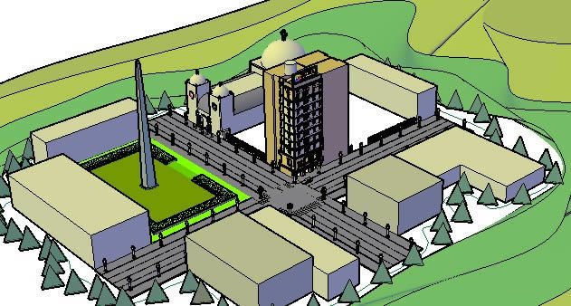
City plan with part of Urbaneja Municipality – Edo. Anzoategui – Venezuela
Drawing labels, details, and other text information extracted from the CAD file (Translated from Spanish):
quota point, topographic point, oil tower, school, isolated trees, channel, Level curve, approximate, curve in depression, sewer bridge, railway, hole, pool, flooded ground, mangrove swamp, sand, grass garden, power line, tower post, contour lines, electrical, in construction, paved road, dirt road, freeway, tunnel, pica, path, hedge, ravine, ravine, lagoon, pipeline, River, cemetery, mount low, culture, forest, scale, spindle m.c., regven horizontal data, scale, range of curves every m., transverse universal projection of mercator, meters, vertical data: mean sea level, wild focal camara, photo scaling, mission date november, on base aerial photographs, digital aerial photogrammetric plane, made by vzla airbrushes. AC., there is no vegetation, note: the plane is precise where, magnetic declination for November, of the, to West, digitized by:, confirmed by:, aerial photogrammetric survey, approved:, made by:, date:, from venezuela c.a., erographies, surface:, Anzoategui State, barcelona pto. the dairy cross, sheet, total sheets:, ref:, series:, total:, digital airfield survey, glove, leaf index, carr., carr, av. monagas, av. freedom, av. anzoategui, av. boulevard, av. the uveros, c. Sucre, the almendrones, c. cardon, av. piritu, av. urban, c. the apamates, c. Paez, av. onoto, c. the lemon, av. bolivar, av. diego b. urban, av. sunday g. lander, c. andres e. White, av. intercommunal, av. walk colon, av. west colony walk, dairies, DC. square, higher, carr., urb., the nose, urb., the nose, old river, urb., Sun Beach, Venezuelan neighborhood, urb., the Palm trees, urb., the hill ii, set resid., morro humboldt, mead, pto. banus, pto. the prince, square, the nose, c. flowers, av. ruiz pineda, c. view, sea, c. Marine, c. rodriguez, c. the carmen, c. the sorrow, av., c. pampatar, c. nva. Sparta, tra, av. powerful shots, c. guanipa, av. araguaney, av. andres bello, av. Cecilio Acosta, c. to. and. White, c. neveri, c. pink mother lives, c. guaiqueri, c. tiuna, av. simon rodriguez, av. fermin bull, c. sock, av. rodrigo de triana, av. urban, c. Arismendi, c. canaima, c. Marisela, c. miss Barbara, c. The Golden, c. Arismendi, c. Madrid, av. tajali, municipality diego b. urban, municipality simon bolivar, ministry of urban development, general directorate of urban development, republic of venezuela
Raw text data extracted from CAD file:
| Language | Spanish |
| Drawing Type | Plan |
| Category | City Plans |
| Additional Screenshots | Missing Attachment |
| File Type | dwg |
| Materials | Other |
| Measurement Units | |
| Footprint Area | |
| Building Features | Pool, Car Parking Lot, Garden / Park |
| Tags | autocad, beabsicht, borough level, city, DWG, edo, municipality, part, plan, planning, political map, politische landkarte, proposed urban, road design, stadtplanung, straßenplanung, urban, urban design, urban plan, Venezuela, zoning |


