Paving Project DWG Full Project for AutoCAD
Paving Project – Plants – Sections – Details
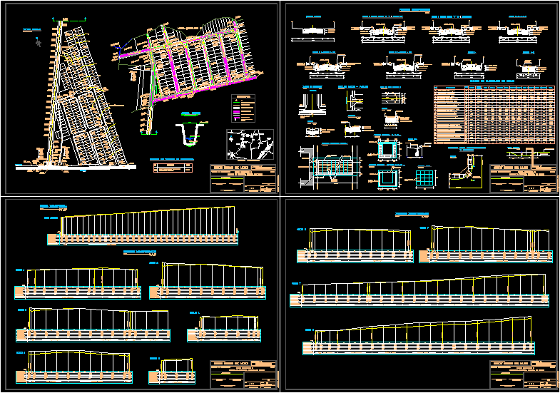
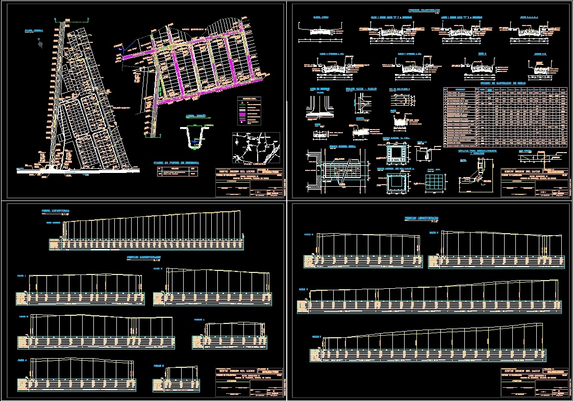
Drawing labels, details, and other text information extracted from the CAD file (Translated from Spanish):
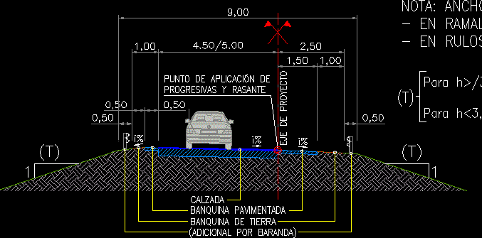
to the palmilla, curve, baden, level entry, exit level, channel, niche ap, channel, c channel, ci, pr niche meter, wall slab, slab, wall, housing service and urbanization, technical unit engineering unit, sector the plume, commune of rauco, date, laminate, format, serviu region del maule, ministry of housing and urban planning, paving project :, previous revision, projected path, passage of the disabled and, rolled, projected floor, floor with projected claw, projected pavement, symbology, technical dept chief, those indicated, scale, plan, loteo quicharco ii, approval, engineering unit, project n, rauco, signature, solera reb., solera with paw, step disabled, solera recessed, green area, gutter, equipment, green area, general plant, existing stabilized base, duster, access road, stabilized base, cross sections, cutting heights, slopes and gradients, embankment heights, partial distances, sub base levels, grade levels, heights of land, accumulated distances, street accseso, asphalt road, baden without joint, asphalt, concrete baden, plant, asphalt road, street axis, street link – passage, court, var., solera type a, solera type c, rented , table of points of reference, projected sidewalk, sandy gravel, ring ci located with prolongation, location, elevation, azfaltica road, supply and, placement, sub base sandy gravel, street axis c, limit loteo, longitudinal profiles, limit norte loteo, construction of concrete bumps, construction rainwater gutter with grid, construction rainwater gutter with cover, excavation in court and transport to dump, construction camera inspection, asphalt base primer, item, table of quantities of works, specification, unit. total, access road, closing line, disabled step detail, inspection chamber, hearth line, detail grid gutter, mesh, grid, top floor, sidewalk, normal floor height, at floor level imento, front view, pavement road, hearth line, and rolled, cut aa, street level, normal sidewalk height, quicharco population, accseso road, projected stabilized base, loteo boundary, mouths, river teno, the alders, the palmilla, callejon the radio, alcantarino alley, the plain, alley, the frogs, punta del, monte, plane location, road, access, supply and placement of vertical road signs, confinement hearth, longitudinal profile, culvert, projected, type a, drainage ditch
Raw text data extracted from CAD file:
| Language | Spanish |
| Drawing Type | Full Project |
| Category | Roads, Bridges and Dams |
| Additional Screenshots |
 |
| File Type | dwg |
| Materials | Concrete, Other |
| Measurement Units | Metric |
| Footprint Area | |
| Building Features | |
| Tags | autocad, details, DWG, full, HIGHWAY, pavement, paving, plants, Project, Road, route, sections |
Related Products


Same Contributor
Featured Products


