Topographic Survey Plan with Contour Lines for 64,625m² Land Parcel

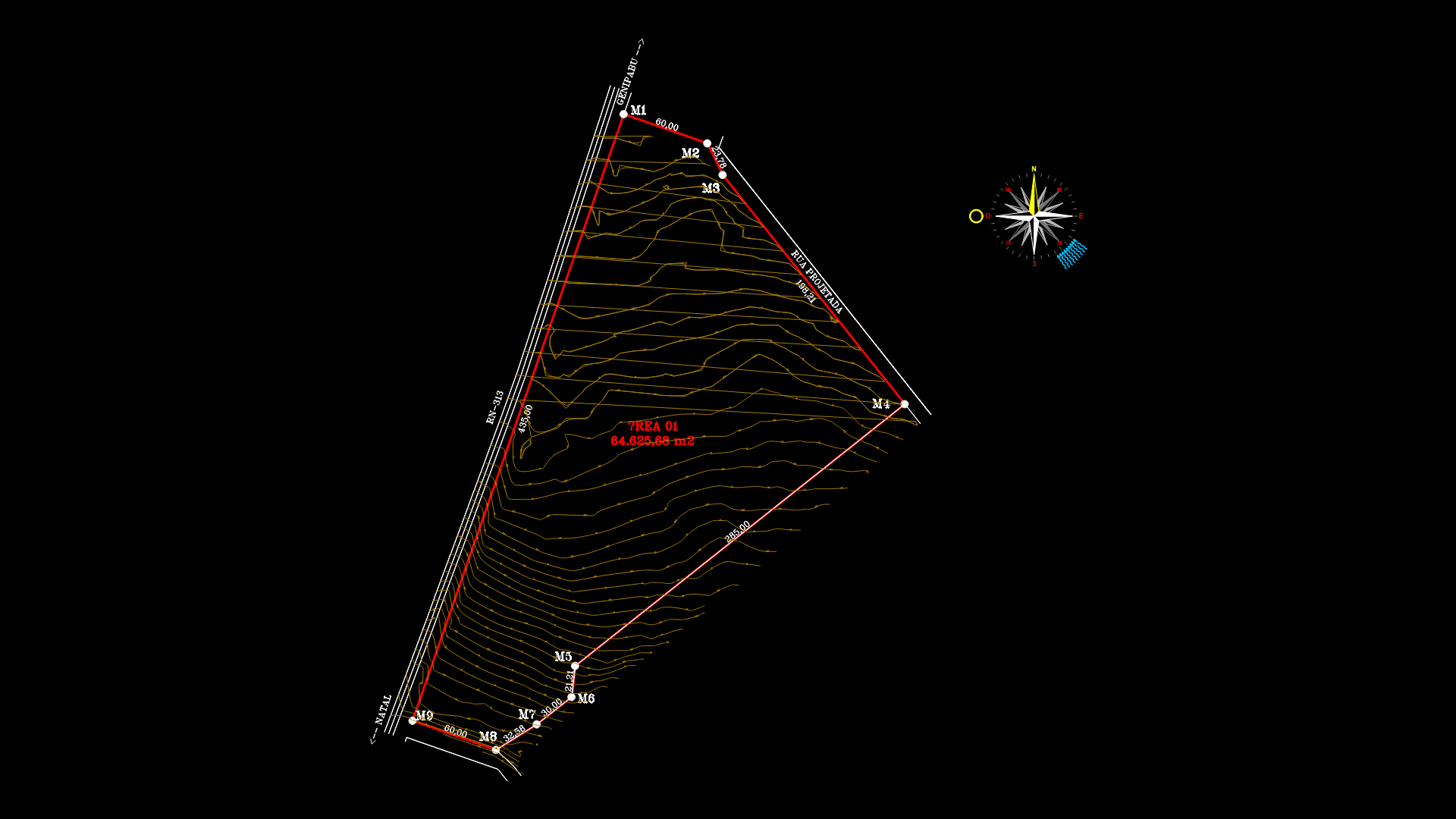
A detailed topographic survey plan depicting Area 01, a triangular land parcel of 64,625.68 m² with comprehensive contour mapping. The survey plot is bounded by 9 survey markers (M1-M9) with demarcated boundaries including a 60.00m frontage along a projected road. The drawing features detailed elevation data with contour lines showing terrain variations ranging from approximately 12m to 32m above reference datum. Topographic points are extensively mapped with over 500 elevation points labeled with coordinates and heights. The site appears to be located between Natal and Genipabu, with directional indicators present. The boundary measurements include segments of 60.00m, 435.00m, 285.00m, and several shorter segments forming the triangular parcel. All survey data is presented in metric units with precise elevation values throughout the site.
| Language | Portuguese |
| Drawing Type | Plan |
| Category | Roads, Bridges and Dams |
| Additional Screenshots | |
| File Type | dwg |
| Materials | |
| Measurement Units | Metric |
| Footprint Area | Over 5000 m² (53819.5 ft²) |
| Building Features | |
| Tags | contour mapping, elevation points, land parcel, property boundaries, site planning, terrain analysis, topographic survey |


