Caracas; Venezuela Plane DWG Block for AutoCAD
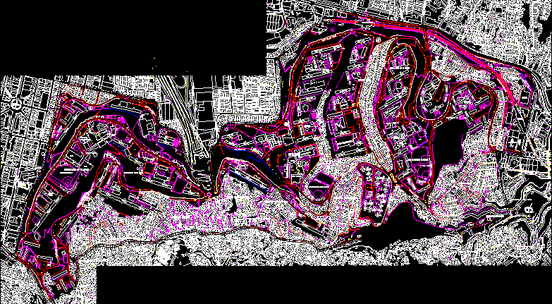
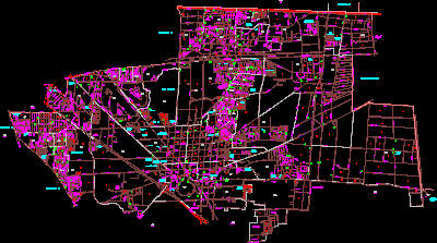
Urban plane of de Caracas; Venezuela; divided by parishes. Parish
Drawing labels, details, and other text information extracted from the CAD file (Translated from Spanish):
basic cycle luis canizalez v., divini maestro school, estadio chato candela, shopping center, civil headquarters, court, kindergarten, plaza, teatro rey cristo, barrio andres eloy blanco, avenue moran, calle colombia, mirador, calle, principal, del, calle libertad, julio, calle diego de lozada, freedom, main street of the mirador, barrio los eucaliptus, barrio la cruz, c. the delights, neighborhood the viewpoint, street for the future, neighborhood observatory, velutini, the observatory neighborhood, neighborhood sierra maestra, sierra, real, teacher, sports field sierra maestra, school bolivar tovar, pre-school foundation of the child, i.n.c.e., qta. the, fight, edif. Spain, qta. lucia, liceo manuel palace fajardo, church, rey rey school, popular mecatiendas, service, station, new dawn center, perez bonalde, boulevard de catia, calle la castellana, calle mexico, calle aguadilla, calle bella vista, calle engracia, tunel la plana, caracas la guaira highway, los caceres street, el boundary street, los higuitos street, third avenue, bellavista, calle bolivar, calle segnini, c. luisa caceres de arismendi, king, christ, street christ king, royal street of sierra maestra, urbanization, street sun of madrid, street the center, street the mill, street andres bello, industrial, street real de los flores, qda. caroata, main street of colombia, parish san juan, oly clemente, kindergarten, sun, pond el, calvario, i.no.s, carmen, villa, barn, edi. the, cjon. the zamuro, delia, edi., graciela, neighborhood monte piedad, land, house, plaza codazzi, parqueelcalvario, calle los pinos, street the obsrevatorio, street the plain, breezes, antonio, san, the neighborhood las brisas, potrerito, plain , rest, jose, calle el carmen, calle el limon, monte piedad, bella, vista, bolivar square, federal school luis enrique marmol, la cañada library, leoncio martinez, diego de lozada, school, pumping station i. n. or. s., park, school: jose gregorio hernandez, military museum, historical, hacienda, ministry, parking, workshops, cjon. the tapon, calle el limon, metro caracas, office, amalia pellin, national school, cjon bolivar, marginal area, gm, calle alameda, dannificados, neighborhood, housing, health water station, martin sanabria, local, montegoma, street lozada, cjon los flores, calle ayacucho, calle real de la cañada, calle miranda, sucre neighborhood, calle los jabillos, metro, callle santa marta, c. san vicente, good advice, monte piedad, main street, lameda street, caroata river, san jose passage, minerva street, los street, sucre avenue, metro station, new water health street, asylum, oaks, main street of monte piedad , castillitos, los, calle el sol, viaduct union, plaza marino, plaza mariño, school, diego street, preschool, pineapples sector, foundation of the child, parish cathedral, parish the pastor, parish sucre, divine, teacher, Lozada, caroata land above, esc., flat, parishes, location, caracas foundation – socialist caracas plan, municipality boundary, parish boundary, paved road, dirt road, road, pica, ruins, construction, legend
Raw text data extracted from CAD file:
| Language | Spanish |
| Drawing Type | Block |
| Category | City Plans |
| Additional Screenshots |
 |
| File Type | dwg |
| Materials | Other |
| Measurement Units | Metric |
| Footprint Area | |
| Building Features | Garden / Park, Parking |
| Tags | autocad, beabsicht, block, borough level, caracas, de, divided, DWG, parish, plane, political map, politische landkarte, proposed urban, road design, stadtplanung, straßenplanung, urban, urban design, urban plan, urbanism, Venezuela, zoning |
