Costa Plan DWG Block for AutoCAD
5 ROUTE OF THE SOUTHERN COAST OF PERU
Drawing labels, details, and other text information extracted from the CAD file (Translated from Spanish):
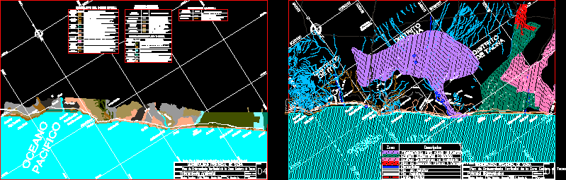
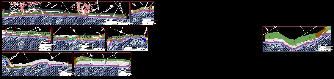
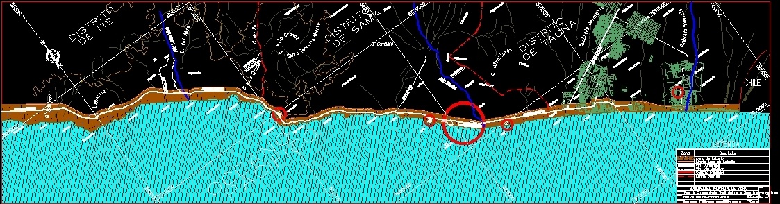
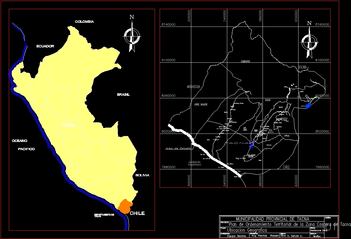
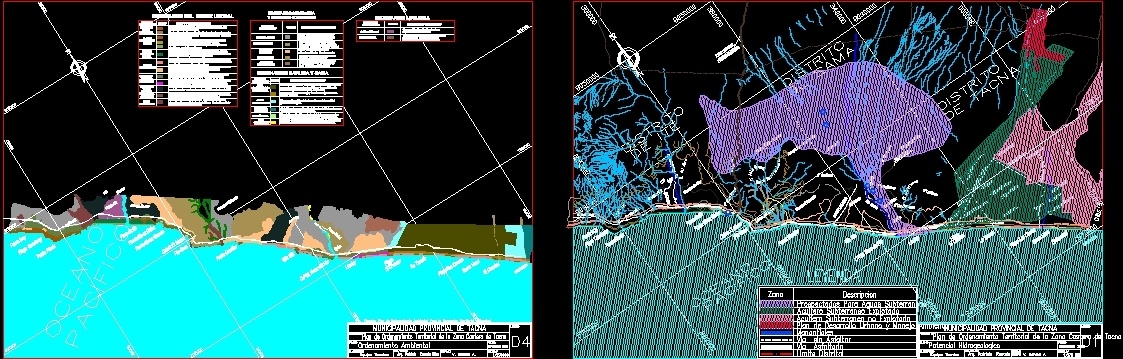
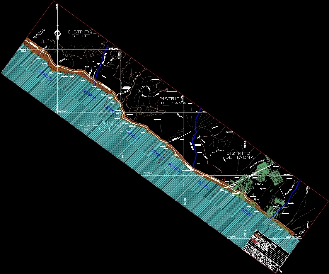
perpetual help, big ranch, pampa la concordia, The sticks, free town, Santa Teresa, the chasqui, san antonio, the pavilions, pampa molina, siquina, the vituña, rio sama, pampa platanillo, the shell, pampa ite sur, miramar, ite, pampa alta, ocean, peaceful, environmental management, territorial planning plan for the coastal area of tacna, provincial municipality of tacna, technical team, Elaborated:, flat:, draft:, arq. patricia rosado silva, v. garcia a., November, drawing, reviewed:, scale:, date:, sheet:, z.l., z.l., z.l., z.l., z.l., z.l., z.l., z.l., z.l., coastal edge scenarios, scenarios caplina sama, coastal deserts, mountain ranges scenarios, Locumba Scenarios, source: environmental planning plan for territorial occupation, concord, the yarada, Beach, gentil point, picata tip, tip mecca girl, caleta el morro, Saint Rose, tip icuy, village village, c.p.m. mouth of the river, llostay, poote of ite, pto grade, the chasqui, playa las cruces, the conchal, big mecca tip, tacahuay beach, what B. from, the salinas, what B., of writings, pampa la yarada, settlement five, hospice station, San Martin de Porres, Progress, pampa la yarada, big ranch, The gaps, pampa hospice, pampa la concordia, The sticks, the olive trees, Santa Teresa, san antonio, the miseries, the yarada, the pavilions, pampa molina, siquina, seven colors, pampa green cross, the vituña, chombo, the glands, rio sama, pampa platanillo, canyon, the huayco, pampa pie de candela, pampa cerro cascoso, the shell, morro de sama, pampa ite sur, big mecca, morrito, miramar, ite, pampa alta, hydrogeological potential, territorial planning plan for the coastal area of tacna, provincial municipality of tacna, technical team, Elaborated:, flat:, draft:, arq. patricia rosado silva, v. garcia a., November, drawing, reviewed:, scale:, date:, sheet:, ocean, peaceful, district boundary, district, from tacna, district, from ite, district, from sama, district boundary, description, prospected for groundwater, zone, legend, springs, coastal road, untapped underground aquifer, road ite, urban development plan environmental management, asphalted road, coastal road, sama road, tacna road, rio locumba, Chile, concord, provincial bound, underground aquifer exploited, unpaved road, district boundary, the yarada, Beach, gentil point, picata tip, tacahuay beach, tip mecca girl, caleta el morro, Saint Rose, tip icuy, village village, c.p.m. mouth of the river, llostay, poote of ite, pto grade, the chasqui, playa las cruces, the conchal
Raw text data extracted from CAD file:
| Language | Spanish |
| Drawing Type | Block |
| Category | City Plans |
| Additional Screenshots |
     |
| File Type | dwg |
| Materials | |
| Measurement Units | |
| Footprint Area | |
| Building Features | Deck / Patio, Car Parking Lot |
| Tags | autocad, beabsicht, block, borough level, coast, costa, DWG, PERU, plan, political map, politische landkarte, proposed urban, road design, route, southern, stadtplanung, straßenplanung, urban design, urban plan, zoning |
Related Products
Same Contributor

Featured Products


