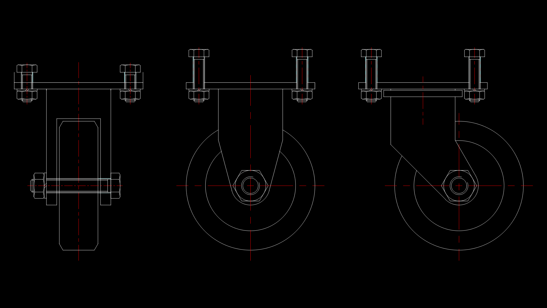
Mixed-Use Development master Plan with Radial Layout and Topography
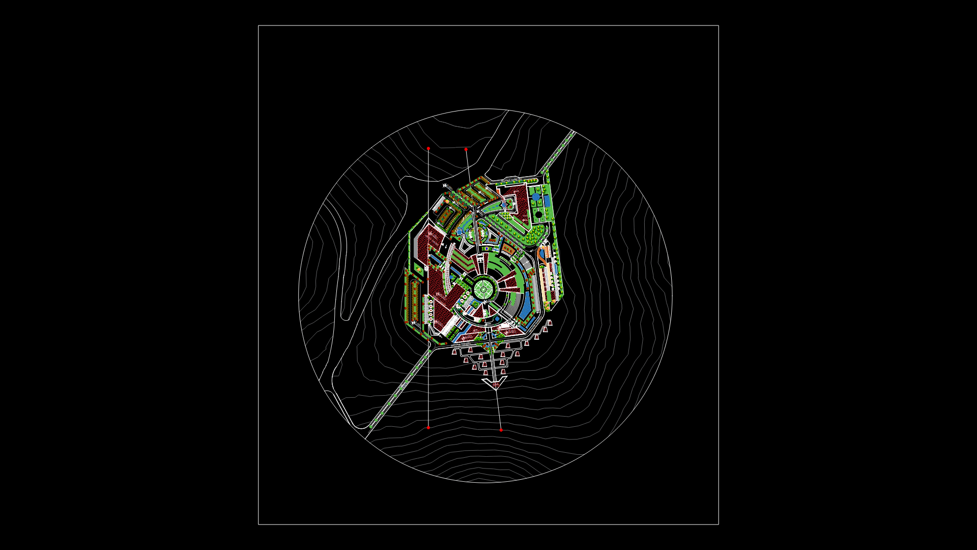
This comprehensive master plan presents a mixed-use development with distinctive radial organization centered around a circular plaza. The site is integrated with the surrounding topography, shown through contour lines that indicate significant elevation changes across the property. Multiple building clusters in burgundy are arranged in a semi-circular pattern, with carefully planned circulation routes connecting them. The development features extensive landscaping elements, including designated green spaces, trees, and shrub areas (indicated on layers L-tree and L-shrub). Water features appear to be incorporated in blue areas, creating visual interest and sustainable drainage solutions. The master plan demonstrates thoughtful integration with the terrain, with access roads entering from multiple points; one main access road extends from the central plaza southward, while secondary paths create a hierarchical circulation network. The design balances built structures with open spaces, creating a campus-like environment that responds organically to the site’s natural topography.
| Language | Arabic |
| Drawing Type | Plan |
| Category | City Plans |
| Additional Screenshots | |
| File Type | dwg |
| Materials | |
| Measurement Units | Imperial |
| Footprint Area | Over 5000 m² (53819.5 ft²) |
| Building Features | Parking, Garden / Park |
| Tags | landscaping, master plan, mixed-use development, radial layout, site planning, topographical integration, urban design |
Related Products
Same Contributor

Featured Products


