New York DWG Block for AutoCAD

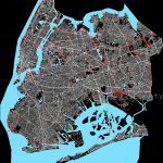
Map Scale New York
Drawing labels, details, and other text information extracted from the CAD file:
kings county, brooklyn borough, new new jersey, new york city, newtown creek, east river, english kills, east river, upper new york bay, east river, upper new york bay, gowanus creek, gowanus bay, prospect park lake, jamaica bay, fresh creek basin, paerdegat basin, mill basin, lower new york bay, gerritsen creek, shell bank creek, shell bank creek canal, plumb beach channel, atlantic ocean, coney island bch, coney island crk, duck point marsh, gravesend bay, hendrix crk, little egg marsh, old mill crk, prospect park lk, ridgewood res, rockaway inlt, ruffle bar marsh, sheepshead bay, stony creek marsh, solomon guggenheim museum, new york transit museum, pratt institute, saint joseph’s college, brooklyn academy of music, brooklyn children’s museum, new york city technical college, polytechnic university, new school for social research, saint francis college, museum of radio and television, american craft museum, new york aquarium, long island university brooklyn campus, city university of new york brooklyn college, monsignor mcgolrick park, park, dyker beach park, kelly park, park, bensonhurst park, drier offerman park, park, lindbergh park, leon kaiser park, manhattan beach park, park, seaside park, park, mccarren park, park, cooper park, lindsay park, ferry state park, maria hernandez park, commodore barry park, mclaughlin park, fort greene park, tompkins park, highland park, saratoga square park, carrol park, park, red hook park, park, prospect park, park, brower park, james byrne park, park, lincoln park, park, fresh creek park, sunset park, park, owls head park, shore rd park, park, mckinley park, marine park, long island rr, railroad, ave, ave, ave, ave, ave, ave, ave, ave, ave, ave, ave, ave, division rd, ave, ave, ave, ave, ave, ave, ave, ave, ave, ave, ave, ave, ave, ave, ave, ave, ave, abbey ct, aberdeen st, adams st, adelphi st, adler pl, agate ct, ainslie st, aitken pl, alabama ave, albany ave, albee sq, albemarle rd, albemarle ter, alder ave, alice ct, allen ave, alton pl, amber st, amboy st, amersfort pl, amherst st, amity st, ancmorage pl, angela dr, anna ct, anthony st, apollo st, applegate ct, arbor ave, ardsley loop, argyle rd, arion pl, arkansas dr, arlington ave, arlington pl, ash st, ashford st, ashland pl, aster ct, atkins ave, atlantic ave, atlantic cmns, auburn pl, aurelia ct, autumn ave, ave, bainbridge st, balfour pl, baltic st, bancroft pl, bank st, banker st, banner rd, banner ter, banner ave, barberry ct, barbey st, barlow dr, bartlett pl, bartlett st, barwell ter, bassett ave, bassett walk, batchelder st, bath ave, battery ave, battle ave, baughman pl, bay st, bay ave, bay pkwy, bay ridge ave, bay ridge pkwy, bay ridge pl, bay side ave, bay st, bay view ave, bay view pl, bayard st, bayview ave, bayview pl, beach st, beach pl, beach walk, beacon ct, beadel st, beard st, beaumont st, beaver st, bedell ln, bedford ave, bedford pl, beech ave, beekman pl, belmont ave, belt pkwy, belvidere st, bennet ct, benson ave, bergen ave, bergen ct, bergen pl, bergen st, berkeley pl, berriman st, berry st, bethel loop, beverley rd, bevy ct, bijou ave, billings pl, bills pl, birch ave, blake ave, blake ct, bleecker st, bliss ter, boerum pl, boerum st, bogart st, bokee ct, bond st
Raw text data extracted from CAD file:
| Language | English |
| Drawing Type | Block |
| Category | City Plans |
| Additional Screenshots |
 |
| File Type | dwg |
| Materials | Glass, Steel, Wood, Other |
| Measurement Units | |
| Footprint Area | |
| Building Features | Pool, Car Parking Lot, Garden / Park |
| Tags | autocad, beabsicht, block, borough level, DWG, map, political map, politische landkarte, proposed urban, road design, scale, stadtplanung, straßenplanung, up, urban design, urban plan, york, zoning |


