Oaxaca State Map DWG Block for AutoCAD
ADVERTISEMENT

ADVERTISEMENT
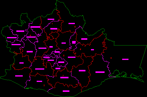
Map of the State of Oaxaca in their regions and districts
Drawing labels, details, and other text information extracted from the CAD file (Translated from Spanish):
juchitan, Tehuantepec, yautepec, mixe, they chop, high villa, ixtlán, tlacolula, ocotlán, ejaculate, zimatlán, center, vega alone, juquila, miahuatlan, pochutla, jamiltepec, putla, Tlaxiaco, juxtalahuaca, nochixtlán, etla, teposolula, silacoyoapám, huahuapan, coixtlahuaca, cuicatlán, I love you, tuxtepec, zaachila, north central
Raw text data extracted from CAD file:
| Language | Spanish |
| Drawing Type | Block |
| Category | City Plans |
| Additional Screenshots |
 |
| File Type | dwg |
| Materials | |
| Measurement Units | |
| Footprint Area | |
| Building Features | |
| Tags | autocad, beabsicht, block, borough level, districts, DWG, map, oaxaca, political map, politische landkarte, proposed urban, road design, stadtplanung, state, straßenplanung, urban design, urban plan, zoning |


