Plano Mochumi – Lambayeque District DWG Plan for AutoCAD
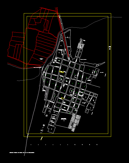
Plan Mochumí District Lambayeque
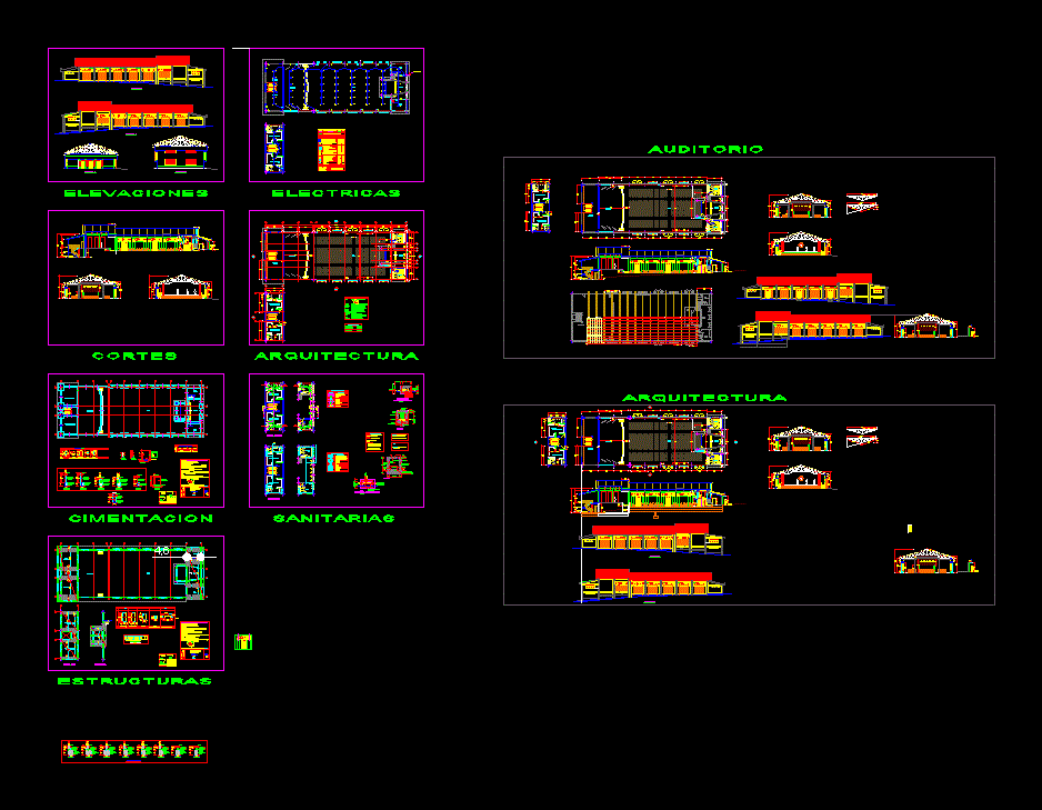
Drawing labels, details, and other text information extracted from the CAD file (Translated from Spanish):
AC. San Martin, ca. San Isidro, ca. Santa Rosa, ca. Miguel Grau, communal service, ca. federico villareal, ca. paschal sack, ca. San Jose, CA. bolognesi, ca. Simon Bolivar, ca. martial barreto, ca. elias aguirre, education, services, water and sewage, other purposes, park, commerce, health services, production area, ca. leoncio prado, a tucume, psje. simon bolivar, land, cultivation, lot, busy, empty, way to caserio wonders, ca. Indoamerica, ca. immaculate conception of the virgin mary, location map, mochumi, pacora, pitipo, tucume, illimo, angelica santamaria santisteban, enrique yet tom, sugar cane, a mochumi, nicolas bances santamaria, street mariscal castilla, calle bolivar, calle, a lambayeque, former panamericana, villarreal, santarosa, miguelgrau, riochancay, cultivation terrain, federico, union, archaeological zone, the, canal, area for, market, illimo, olaya, jose, colegio, franciscobolognesi, passage, to v. a n d s a a. c a c e r e s, j o r g e c h a v e z, tucume mill, d e m e t r i o c a t a, v i c t o r a. b e l a u n d, c a r r e p a n a m e r a n c e n t, p a v e, t e r r e n d e d s, roads to farm fields, town, huaca del, cerro, cueto, prolon. san marcelo, c a l l c e e t, to elms, cemetery, calle los incas, av. august b. leguia, convent street, victoria, santa, a v., federico, street san pedro, street san marcelo, rosa, federico villarreal, ce, acequia the town, milk, irrigation ditch, pasture the mercy, huaca de la cruz, sapame, huaca mercy, poma, noria poma, huaca rodillona, huacas botha, the bar, rescue, matrix community, hda. santa matilde, santa adelaida, san jose, river, r otaymi, urban, area, road, urban area, huaca, northern old panericana, panamericana road to tucume, zl, cachinche, caserio, nancolan, farmland, large ditch, acequia felipe, a piura, pj, district of, sports area, ca. zurita, ca. Victor Raul Hay from the Tower, ca. Luis Felipe of the houses, of third parties, property, property of third parties, ca. Daniel Asalde, ca. martires de chan chan, ca. real, reserved area, traditional village, ca. Mr. of miracles, ca. Chimoy, Evangelical Church, Sarmiento Channel, Casa Huerta, ca. próceres de la indep., fifth carolina, mill, ca. Oscar Barreto, ca. s. santisteban, ca. nicolas ayllon, pumping chamber, agro bank, cotton warehouse, tap, deposit, sunarp, secondary school, a. b. leguía, police station, municipal ceo, municipal stadium, josé mercedes rios, brewery, mozaic road to mochumi, pronoei, water well, plane :, project :, responsible :, district municipality of mochumi, current lotizacion, date :, scale :, —, district :, province :, lambayeque, department :, drawing :, property of innocent branch, garage, construction of tap, possible starting point of way of avoidance, municipal property, plot, original, marilyn guadalupe warrior, street san martin, dist., prov., dept., property:, owner:, date, total area, perimeter, scale, lotizacion, location scheme, technical data table, location – location, owners :, lamina:, location and location , autocad, indicated, area of the block, apple, street, center, province, district, department, lamabayeque, north, south, east, west, vertex, side, distance, angle, ab, bc, cd, da, area of the lot, san isidro, front, right, left, background, association On May Day, perimeter and area measurements chart, lat. left, lat. der., area, perimeter – location, subdivision of lot, sector, lusby ventura ilma, traditional village of mochumi, simon bolivar, nativity lina moreno vilela, subdivision of the lot, perimeter matrix, enrich ramos chinchay dorilla cherres de chinchay, bf, faith, sub division of lot matrix, ef, fc, of, sub lot, owners, legend, jaime ubillus barreto esther sialer de ubillus, july, ae, fg, gc, eb, bg, gf, guzman aquino wed, rosalinda siesquen morante, miguel grau
Raw text data extracted from CAD file:
| Language | Spanish |
| Drawing Type | Plan |
| Category | City Plans |
| Additional Screenshots | |
| File Type | dwg |
| Materials | Other |
| Measurement Units | Metric |
| Footprint Area | |
| Building Features | Garden / Park, Garage |
| Tags | autocad, beabsicht, borough level, district, DWG, lambayeque, plan, plano, political map, politische landkarte, proposed urban, road design, stadtplanung, straßenplanung, urban design, urban plan, zoning |
Related Products
Same Contributor


Featured Products


