Profiles Of Streets DWG Block for AutoCAD
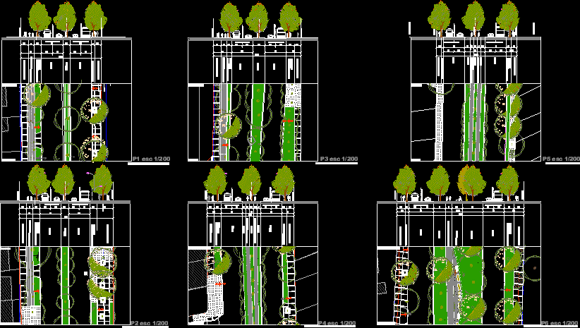
Profiles of Streets – San Joaquin; Santiago de Chile
Drawing labels, details, and other text information extracted from the CAD file (Translated from Spanish):
arb, veronesse, boticelli, arborization axis, official line, south departmental axis, building line, south departmental road, antejardin, north departmental road, north departmental axis, footpath – strip walk, bike path – strip recreational track, road, bandejón, strip security, services and green area, diego de meza, nva. berlioz, j. Greek, fco. of castañeda, safety belt and services, safety belt, services and green area, painter durero, francisco de toledo, tomas de campanella, benozzo gozzoli, rest area, central departmental axis, central departmental road, industries, tomas de campañella, gustavo bell , walking belt, visviri, port montt, from nva. berlioz to diego de meza, from fco. from castañeda to juan greek, from painter durero to francisco de toledo, from juan greek to painter durero, from benozzo gozzoli to tomas de campanella, from boticelli to veronesse, from industries to gustavo campana, from campanella takes to industries, from matte stolen up turquino, from puerto montt to visviri, from el chincol to vicuña mackenna, stolen matte, turquino, el chincol, vicuña mackenna
Raw text data extracted from CAD file:
| Language | Spanish |
| Drawing Type | Block |
| Category | Roads, Bridges and Dams |
| Additional Screenshots |
 |
| File Type | dwg |
| Materials | Other |
| Measurement Units | Metric |
| Footprint Area | |
| Building Features | |
| Tags | autocad, block, chile, de, DWG, HIGHWAY, pavement, profiles, Road, route, san, santiago, streets |

