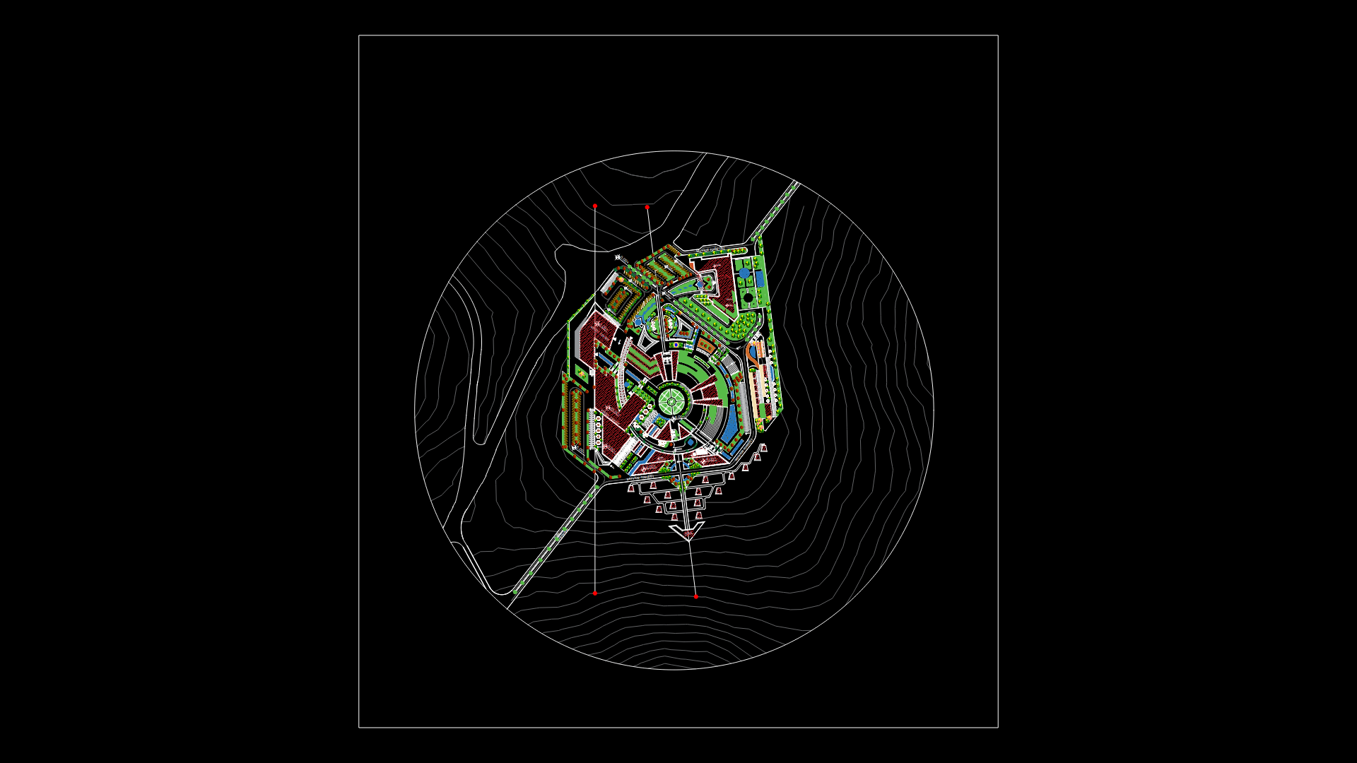
Puerto Libre – Landmarks And Nodes DWG Block for AutoCAD
ADVERTISEMENT

ADVERTISEMENT
Location landmarks and nodes at district Puerto Libre – Lima
Drawing labels, details, and other text information extracted from the CAD file:
t.e.c., t.s.c., t.e.c., s.n., s.n., t.s.c., t.s.c., t.s.c., t.s.c., t.s.c., t.s.c., t.s.c., t.s.c., t.e.c., t.s.c., t.s.c., t.e.c., t.s.c., t.s.c., t.e.c., block, t.e.c., tsc., tsc., tsc., tsc., t.e.c., t.s.c, t.e.c., t.s.c., t.e.c., t.s.c., terreno, construccion, terreno, construccion, terreno, construccion, terreno, construccion, terreno, construccion, tsc., t.s.c., tsc., entrada, t.s.c, t.e.c, terreno, en construccion, terreno, en construccion, t.s.c., terreno, construccion, terreno, construccion, block, terreno, construccion, t.e.c., tsc., t.e.c., t.s.c., terreno, construccion, t.s.c., t.s.c., t.s.c.
Raw text data extracted from CAD file:
| Language | English |
| Drawing Type | Block |
| Category | City Plans |
| Additional Screenshots |
 |
| File Type | dwg |
| Materials | Plastic |
| Measurement Units | |
| Footprint Area | |
| Building Features | Car Parking Lot |
| Tags | autocad, beabsicht, block, borough level, district, DWG, libre, lima, location, nodes, political map, politische landkarte, proposed urban, puerto, road design, stadtplanung, straßenplanung, urban design, urban plan, zoning |
Related Products
Same Contributor

Featured Products


