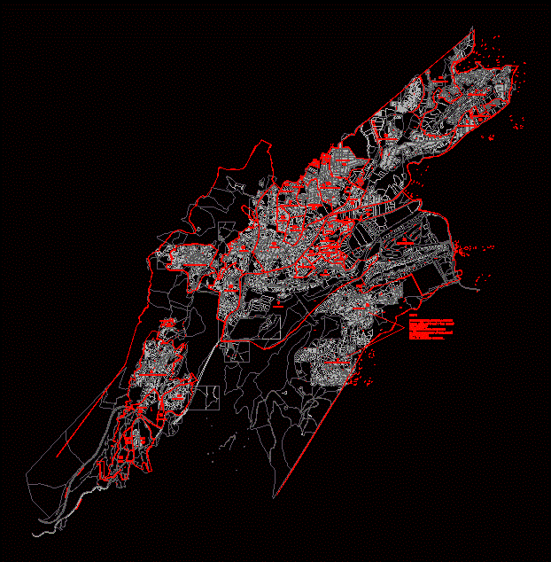
San Pedro Sula – Plano DWG Block for AutoCAD
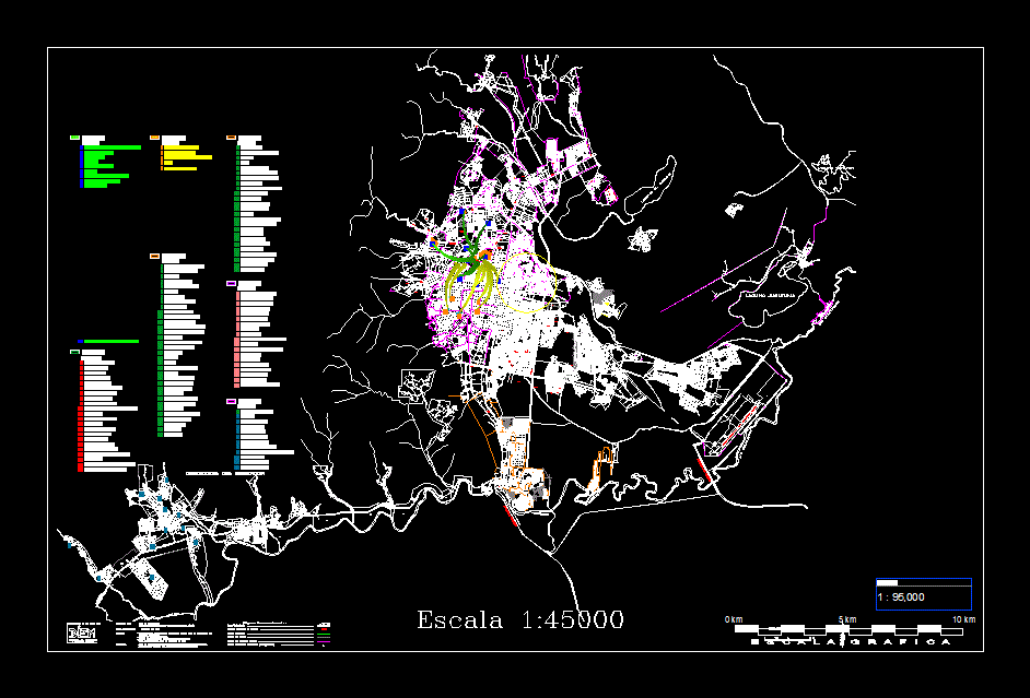
SAN PEDRO SULA – PLANO
Drawing labels, details, and other text information extracted from the CAD file (Translated from Spanish):
highway to progress, base fah, access to fah, old platform, riochamelecon, international airport ramon villeda morals, taxiway, light aircraft, platform, runway, control tower, runway channel, future platform, perimeter board, dirt road , passenger terminal, access boulevard, new terminal, cargo, approach lights, lagoon jucutuma, main street, lagoon ticamaya, river chamelecon, highway to villanueva, south boulevard, field agas, successors munoz, Honduran sugar company sa, municipal lot, associacion employees of polymer, cooperative america, seventh avenue, sixth avenue, fifth avenue, fourth avenue, fourth street, fifth street, sixth street, seventh street, cemetery, eighth avenue south – east, third street, second street, third south avenue – east, cañeras, quinel, passage, quinel, boulevard, second ring of circumvallation, ravine, board, wall, wall, street, retaining wall, san jose street , to tegucigalpa, ravines, green area, bird. barcelona, country Valladolid, Calle Elche, Murcia Street, Ave. madrid, bird. central, bypass, c a n e r a s, caneras, paddocks, road to s.p.s, west road, toyota, sps-el progreso, passage soledad fernandez, passage villeda morals, kennedy passage, avenue bypass, p a s a j e v i l e d a m o r a l e s, p a s a j e k e n n e d y, ave. circumvallation, river stones, passage to, passage b, passage c, old exit to the lime, second peripheral ring, main street, river willow, boulevard del norte, rio bermejo, area not edificandi, green, area, right of way enee, white river, junior avenue, first street, green area, highway to puerto cortes, main entrance, reserve area, municipal lot, main street, commercial area, municipal area, guamilito, market, military school of the north, qda. of rocks, urbanizadora sula s.a., qda. santa ana, coffee farms, to work, broken the palm, label coca cola, streams, xxxxxx, to the dam, pipe dima, boulevard to the hospital m.c.r., river stones, prolongation boulevard morazan, bird. juan lindo, calle cabanas, municipal lot, calle juarez, ave. valley, street bolivar, street morazan, bird. neighborhoods, bird. herrera, central avenue, the salle, pizza hut, cinema gemini, stadium morazan, intae, holiday inn, nova hurry, multiplex square, u-sps, bamer, cts, passage bogota, passage cali, passage medellin, passage the soldier, hospital mcr, santa ana river, xxxx, dam, sanpedrana, international, school, mountain, san jose de las flores, boulevard las towers, cich, santa ana avenue, banpais, curn, callejon, south street, north street, area social, municipal area, commercial area, unloading area, judicial morgue, xxxxx, avenue, quebrada, rio armenta, hacienda, a hacienda, calle las acacias, calle el roble, calle los alamos, metroplaza, hondureña, brewery, nursery, mill harinero, xxx, the palenque, ihss, street no, avenida el manzano, avenue el cedro, calle el roble, uth, unitec, rio chiquito, rio zapotal, xxxx, frate, avenue fraternidad south-west, model avenue, north west road , avenue west fraternity, bird nida fraternidad oriente, north-west road, first east street, first west street, rnidad, nor west, central street, centennial avenue, south-east, fraternity, north-east road, north-east, hill, xxx, toll, lagoon the carmen, channel, municipal area, magdalena pineda, harry panting, avenue versailles, cd, security area, channel, board, cricket, first avenue, second avenue, third avenue, water tank, church, catholic, soccer field, area, green, communal area, river willow, qda. of palm trees, river, stones, qda. the palmar, crematorium, qda. squid, qda. san bartolo, river manchaguala, r i o n a c o, qda. san lorenzo, qda. the pita, pedestrian passage, qda. el corbano, to the west, pas.d, naco river, flood zone, prepared by: digitization area, sources: -catalogical surveys elaborated by the cartography area of the municipality of san pedro sula, research direction, and municipal statistics, deserndon mountain range, -plan provided by lotificadoras companies, -gps points taken from the area of remote positioning, -plains of municipal cadastre, conventional signs, neighborhood or neighborhood code, urbanized area, municipal boundary, boundary of sector, boundary of neighborhood or colony, true north, magnetic north, north grid, pedestrian, marine p . from mendieta, pas. Froylan Turcios, country. august c. coello, country j.c. from the valley, pas. block, country santos guardiola, eighth street, fifth street, fifth avenue, sixth avenue, fourth street, calpules street, journalists boulevard, a chotepe, commercial lot, lima highway, c or l. p l a n e t a, m
Raw text data extracted from CAD file:
| Language | Spanish |
| Drawing Type | Block |
| Category | City Plans |
| Additional Screenshots |
 |
| File Type | dwg |
| Materials | Other |
| Measurement Units | Metric |
| Footprint Area | |
| Building Features | |
| Tags | autocad, beabsicht, block, borough level, DWG, flat, pedro, plano, political map, politische landkarte, proposed urban, road design, san, san pedro sula, stadtplanung, straßenplanung, sula, urban design, urban plan, zoning |
