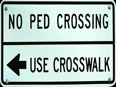
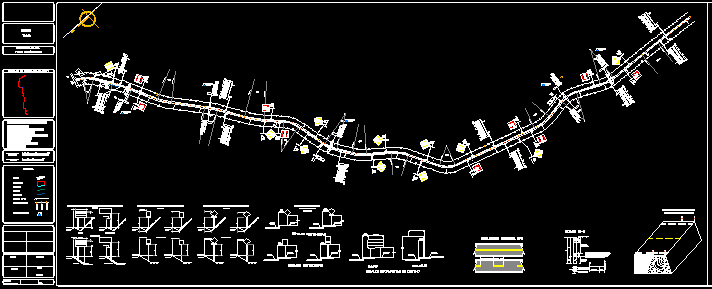
Signaling Project DWG Full Project for AutoCAD
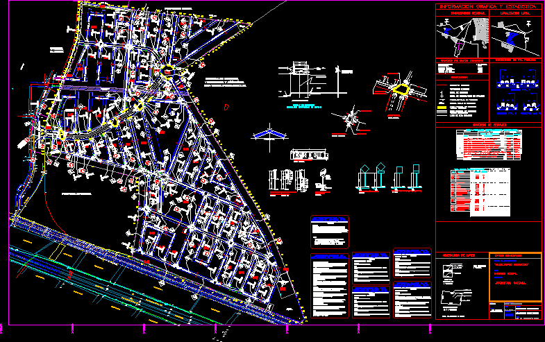
Project of signaling horizontal and vertical in social interesting fractionation
Drawing labels, details, and other text information extracted from the CAD file (Translated from Spanish):
north, sidewalk, face, camellon, road section a, road section b, road section c, concept, total area, salable, residential area, commercial area, salable subtotal area, urban equipment area, green area, high tank area , area of service step, area for well, area of treatment plant, area, right, generated, by pemex pipeline, road area, total, block, no. of salable lots, surface, residential, commercial, total, multifamily, single family, total lots, housing, salable area, total, text, maximum, sidewalk, stream, union with electric welding., dimensions in centimeters., sheets of signs, construction detail, informational candlestick destination, main street, no scale meters mts., pedestrian crossings main roads, secondary pedestrian crossings, stripe stop, stripe rail separator, continuous, discontinuous, continuous single line, continuous double line, date of direction of circulation, specifications of, horizontal direction, specifications for, low vertical direction, fixation, and nut, all in galvanized material., dimension:, nomenclature informative signage, the board will be of rectangular shape with rounded corners with radio, shape :, material :, support :, and enamel matte gray finish., restrictive signaling, reflective red background g engineering, white letters and fillet in, refining finish engineering degree., equilateral triangle, with a vertice down., black color., contained in the manual of devices for traffic control in streets, and roads, preventive signage , flat and nut, all in galvanized material., will be placed with a vertical diagonal., destination informative signage, see specifications of materials and colors, of devices for traffic control in, as well as dimensions in the manual, note: , the installation of the support will be carried out previous excavation of the stock with the, installation:, perpendicularity to the axis of the road and that the distance between the edge of the board and the number of houses, number of housing lots, number of blocks, av . Aztecs, geo houses, restriction by railway, profile of the line, sanitary network, central camellon, private property, entry to country geovillas, pit, access, telmex air cables, cfe. cables, reg.te telmex, telmex, cfe , reg-cfe, reg-tel, donation, a.verde, commerce, site, pemex restriction, service step, av aztecas, a. green, houses shows, well, treatment plant, inca street, boulevard paseo palma real, paseo de acozac, ride of suchilapan, tehuantepec walk, tuxtepec walk, tinaja walk, zoongolica walk, orizaba walk, papantla walk , walk of coatzacoalcos, walk of alvarado, walk of amatlan, walk atoyatl, walk of mouth of the river, walk of cardel, walk of cordoba, walk of cuitlahuac, walk of tecolutla, walk of tecatepec, walk of tajin, walk of cempoala, fortin walk, cosamaloapan walk, catemaco walk, chachalacas walk, ixtlahuatlan walk, minatitla walk, cuichapa walk, papaloapan walk, perote walk, tuxtla walk, jalapa walk, mocambo walk, walk mandinga, paseo de mixtlan, paseo de veracruz, tepozan promenade, texistepec walk, texcalli walk, kukulcan walk, tlacotalpan walk, hacienda walk, tepetl walk, tetlalpa walk, veterinary and zootechnics, medical school , veracruzana university, sanchez, colonia, property cuara, elevated tank, name decalle, location of preventive signal, without scale, folder, location of restrictive signal and informative, secondary street, the levels are in meters, unique, date :, graphic and statistical information, local location, plane signaling, scale :, no. of plane :, name of the plane :, name :, expert :, project :, drawing :, regional location, sections of public road, general data, name of the subdivision :, type :, location :, social interest, summary tables, symbology, density data box, lot type, length of boundary, number of houses, lot area, lot number, north, juchitan, oaxaca, population density, total population, single-family lot, multifamily, symbolism of lots, multifamily lot , existing face, existing garrison, project sign, project nomenclature sign, simple project arrow, double project arrow, project pedestrian crossing, high project line, main road, secondary road, dimension, pavement markings, pedestrian crossing stripes, reflective yellow color, high or stop stripes. reflective white color, continuous double central stripe, reflective white color, key, description, length, continuous single stripe, reflective white color, pedestrian crossing stripes, reflective white color, inclined stripes in neutral zone of needles, reflective white color, stripes perimeter to delimit
Raw text data extracted from CAD file:
| Language | Spanish |
| Drawing Type | Full Project |
| Category | Roads, Bridges and Dams |
| Additional Screenshots |
 |
| File Type | dwg |
| Materials | Other |
| Measurement Units | Metric |
| Footprint Area | |
| Building Features | |
| Tags | autocad, DWG, fractionation, full, horizontal, interesting, Project, schilder, Signage, signaling, SIGNS, sinalização, social, vertical |


