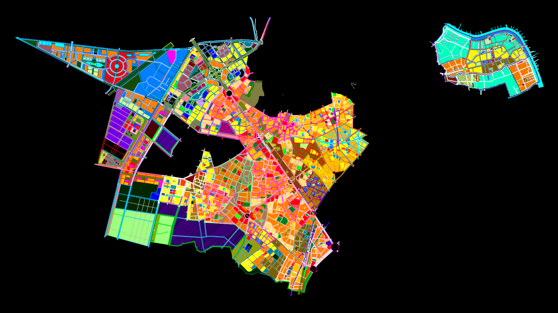
Subdivision Land Use Map Alto Trujillo, Peru DWG Block for AutoCAD

Rising subsector land uses 1A, the High Human Settlement Trujillo in Trujillo, La Libertad, Peru.
Drawing labels, details, and other text information extracted from the CAD file (Translated from Spanish):
av. the laurels, passage, AC. of July, passage, AC. of July, Street, Street, high trujillo neighborhood, avenue one, Street, street extension, tupac amaru, Street, avenue of, Street, avenue of, Street, avenue of, Street, avenue of, Street, las margaritas avenue extension, education, less, pzm, zonal park, pi., laurels iii, av. francisco bolognesi, high trujillo, applications, legend, description, symbol, housing unit, housing trade, cellar, bakery, Barber Shop, housing workshop, uninhabited lots, fenced, edification, wasteland, abandoned, others, Commerce, invasions, Initial education, other radios, public recreation, members, theme:, high trujillo, flat number:, flat:, land use plan, sector, plan of materials walls, esc .:, sector, as can be seen in what predominates is the dwelling followed by the uninhabited plots for last dwelling being able to appreciate in addition that there is not enough equipment for the amount of population that the few lands that are destined for the equipment have been invaded by people without living place.
Raw text data extracted from CAD file:
| Language | Spanish |
| Drawing Type | Block |
| Category | City Plans |
| Additional Screenshots |
 |
| File Type | dwg |
| Materials | Other |
| Measurement Units | |
| Footprint Area | |
| Building Features | Car Parking Lot, Garden / Park |
| Tags | alto, autocad, beabsicht, block, borough level, DWG, high, human, la, land, land use, libertad, map, PERU, political map, politische landkarte, proposed urban, rising, road design, stadtplanung, straßenplanung, subdivision, trujillo, urban design, urban plan, zoning |
Related Products


Same Contributor


Featured Products


