Tarija DWG Block for AutoCAD

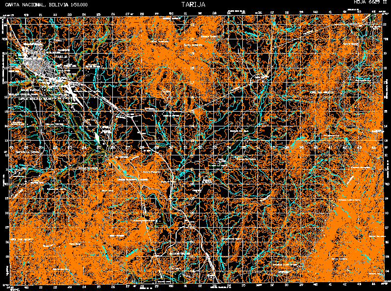
Mapa Topographic map of Tarija. City Hoja 6629 – II Original fount IGM (Instituto Geográfico Militar) scale 1: 50.000 Coordinate UTM. Datum PSAD – 56
Drawing labels, details, and other text information extracted from the CAD file (Translated from Spanish):
san jacinto stay, big ancon stay, San Isidro, cmdad, tolomosa boy, san blas community, community, large plank, san geronimo, the weaving, miraflores, the carmen, villa avaroa, villa, aniceto arce, villa fatima, juan xxiii, community, white hills, portillo stay, san antonio accommodation, stay, the graffiti, stay north side, cieneguillas stay, stay fallow, gamoneda stay, large hillside community, san agustin sud, San Agustin, north, san agustin sud, Saint Ana, saint Louis, stay, the storm, the narrow season, san jacinto school, stay ancon, stay sunchu waykho, stay stay, chorrillos accommodation, lourdes, quarry, cemetery, hacienda hut, chapel, the cross, hacienda san miguel, miraflores farm, industrial cooperative, soccer field, court, soccer, agronomy school, barrack batallon chorolque, ing, padilla barrack, barracks dest. air no., airport cap. ariel read plaza, hundred, soccer field, court, soccer, cemetery, soccer field, court, soccer, soccer field, tarija, Cerro Santellon, hill ancon, hill covered, hillside, Hill, pampatrigo, hill meson, I fallow, monte gamoneda, battlefield the plank, palmarcito, the narrow, alley chanaris, serrania la tablada, hundred, tel, large plank pampa, open san jacinto, abra san agustin, hill picacho, ford, quarry, tarija, loma san juan, uriondo km., stay ventolera km., junacas km., caldera chico km., tolomosa km., school community tablada chico km., san lorenzo km., stay chullpa km., stay beams km., carta bolivia, sheet ii, tarija
Raw text data extracted from CAD file:
| Language | Spanish |
| Drawing Type | Block |
| Category | City Plans |
| Additional Screenshots |
 |
| File Type | dwg |
| Materials | |
| Measurement Units | |
| Footprint Area | |
| Building Features | Car Parking Lot |
| Tags | autocad, beabsicht, block, borough level, city, DWG, gas, ii, map, mapa, original, political map, politische landkarte, proposed urban, road design, stadtplanung, straßenplanung, topographic, urban design, urban plan, zoning |


