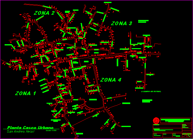
Town San Andres Xecul Totionicapan – Guatemala DWG Block for AutoCAD

Town of districtSan Andres Xecul Department Totonicapan – Guatemala Republic
Drawing labels, details, and other text information extracted from the CAD file (Translated from Spanish):
access, floor plan urban, scale, access, zone, Street, alley, football field, area of future, Street, square, publish, municipality, avenue, access, access, avenue, church, alley, avenue, Street, avenue, alley, avenue, san andres xecul, alley, access, alley, alley, alley, alley, alley, Street, avenue, alley, alley, alley, alley, access, access, access, cemetery, alley, Street, avenue, Street, Street, alley, alley, avenue, palomora, Street, alley, avenue, Street, Street, avenue, avenue, avenue, Street, avenue, Street, avenue, alley, Street, alley, alley, Street, access, Montana, san felipe village, xejuyup, Street, battery, avenue, Street, avenue, access, access, Street, access, Street, Street, avenue, avenue, Street, alley, alley, Street, via, Street, via, Street, avenue, avenue, Street, avenue, alley, alley, nimasac, tank, of water, alley, alley, alley, Street, Street, the mountain, avenue, access, access, alley, development, area of future, University of San Carlos of Guatemala, architecture facuilty, floor plan san andres, first name:, content, saulo b.p.c., license:, draft:, February, sheet no., arq. german, adviser:, bucaro, sheet no., graduation program by eps, scale:, date:, indicated, Guatemala
Raw text data extracted from CAD file:
| Language | Spanish |
| Drawing Type | Block |
| Category | City Plans |
| Additional Screenshots |
 |
| File Type | dwg |
| Materials | |
| Measurement Units | |
| Footprint Area | |
| Building Features | Car Parking Lot |
| Tags | autocad, beabsicht, block, borough level, department, DWG, guatemala, political map, politische landkarte, proposed urban, republic, road design, san, stadtplanung, straßenplanung, town, urban design, urban plan, zoning |


