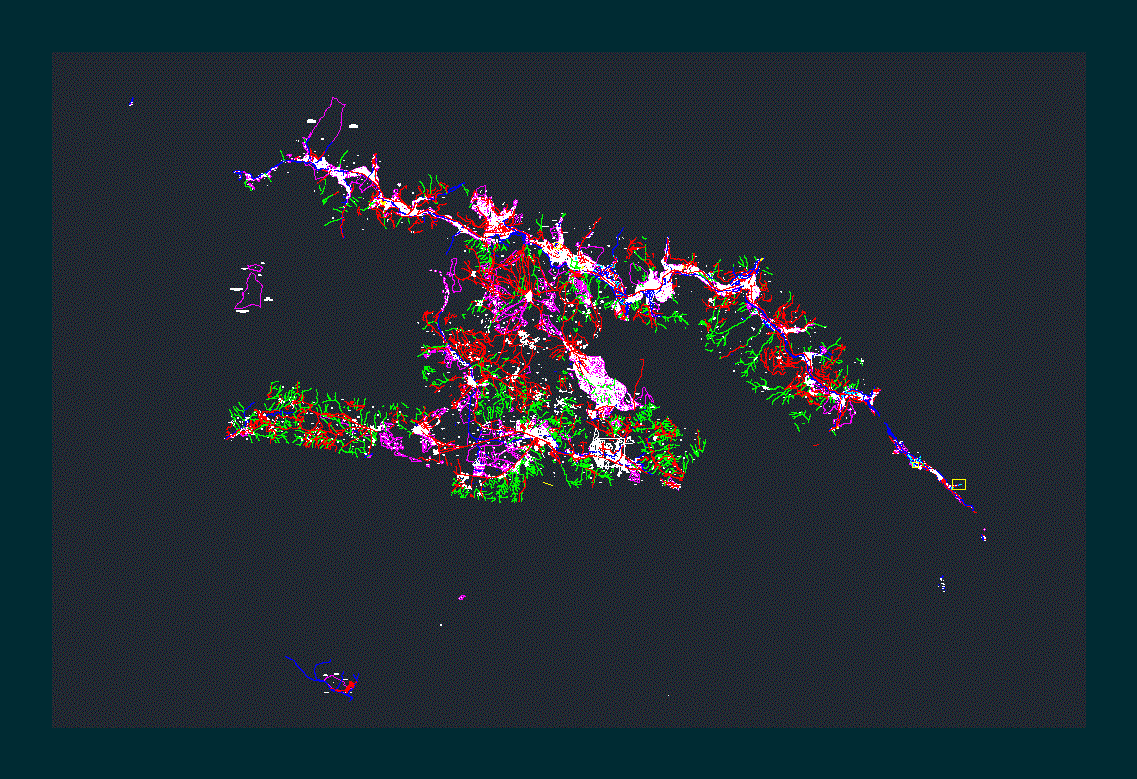
Valley Of Cusco Plan DWG Block for AutoCAD

URUBAMBA CUSCO PERU
Drawing labels, details, and other text information extracted from the CAD file (Translated from Spanish):
acequia, huayocari stream, lagoon, yanaccocha, vilcanota river, vilcanota, river, canal, torrecampanayoc stream, chuquibambilla, creek, creek, nameless, brick, huayccoo, uchuycosco, sacllo, huayco, tancaccasa, sonccon, llullucha, chihuanco, tamar riachuelo runtumayo river, huaytampo, ramicancha, rio tanccac, ccarpacmayo, pumahuanca, san, juan, antahuaylla, titocpata, huayllaccata, ccatun, tullti, cuchuy, yanamayo, racchihuaycco, cuchiwasi, orchard, chayoc, japinuno, carmen, achimbray, river vilcanota, irrigation canal, callicanto, rio huarocondo, piachimayo, reservoir, pools of, oxidation, banks, sand, huayllccata, santa huaycco, condor, mescco, nacnun, quebrada harin, huqqui stream, poza de, riberena area, lagoons, rocococha, jopicocha, huaran river, tancac, pond, uncachaca river, hill, huaycco, cconoc, huayocari, vilcanota river, drain miraflores, socco huaycco stream, sambor, huarocondo, santa, maria, rio llancamayo, tangabamba, sayacachi, sanjuaycco quebrada, ci luscunahuayllaray, ccoyuna, chacapunco, tacaray, tucunayoc, siremayoc, cachimayo river, fortress, quayco, lagoon eqqecco chacan, iscaychaca, yahuarmaqui, rio corimarca, laguan, coyocoper, collcca, colccabamba, miraflores drem, miraflores drain, artificial drain natural terrain, river colorado, ccoripucyo or, riochuelo motaque, drainage, ccoyabamba, swamp area, drain, umansayak, umansayoc, colorado, drainage channel, ccoyomayo, lake de hauypo, rio pitumayo, rio zurite, irrigation canal, rio patacancha, marginal belt, cconchacalla , irrigation channel, huaypo lagoon, dry lagoon, manante, quebrada quebradayoc, chanchayllo lagoon, huaypo lagoon large, lagoon, drain, irrigation ditch, san juan stream, drinking water, intake, spring, canal conduction, catchment, swamp, huachac, llamamoto, chicllor, canalized stream, sand bank, oxidation pond, chuecamayo stream, reserv., qda. ampay, rio chongo, takes, irrigation channel to, pillahuara, pilhuara, rio apurimac, underground channel, rio chicon, rio ccochoc, reservoir, irrigation canal, chicon estate, truck path to pumahuanca, site, ccoronta, salt mines, map achu , road disused, cap, field, sports, housing, school, farm huycho, sector huandar, ipss, cemetery, area, urban, a, school, stadium, municipal, congregation, salesiana, hill chucus, truck trail, calca – huandar , pisac – calca, old road to calca, asphalt road cusco – urubamba, tap, technical, clorinda matto, populated center, cau the incas, huqquikankan hacienda, street gardens, asoc. pro, housing, to rayanpata, area for the exploitation of, material of construction, municipal lamay, hill tucumachay, hill callaray, center town cau, the incas, asphalt road cusco calca, calca pisac, hill ccaccatopata, hill huanca juqui, association poductores, huancco farming, cuzco – calca, querapucyo, rumi cruz hill, paucartica, cau, huchuy ccosco, uchuyraqaqay hill, pucaqasa hill, adj. a la cau, christ salvador de urco, adj. to the c.a.p., uchuy ccoscco, adj. to the peasant community, cuper, urpihuata, clouds, archaeological zone, huchuy ccosdco, road, horseshoe, huqqui kankan, affected area, bridle path, huandar, chico, cau. jose zuniga Latvia, street, pachacutec, road, old, asoc., prov., viv., proviv., asphalt track to coya, asphalted, pisac coya, horseshoe, to patabamba, trail, carriage, trail c., pedestrian, tucsan, kewar, urban explosion zone, urban area, pisac, pisac archaeological site, uyninpampa hill, inia, asphalt road cusco pisac, antenna house, church, sector ii, maras, road in disuse, Achoro land, eriazo, tancac site , rural community, wakay willki, prediophiry, sacred valley phiry, farmhouse, road to machuc pichucc, lourdes, center, educational, primary, chapel, chillca, zone eriaza, sellque, cajon, longuina, camicancha, station, ffcc, tanccac eriazo rumira ccapac, inca ollanta, rumira farm, pasohuaycco carrozable trail, marampampa carrozable trail, eriaza area, quillillo, quillillopampa, kacllapaccay, machupicchu, line, ferrea, cusco, inca, eriazo reverted to the state, pachar estate, cachicata, cap, spring, line ferrea to ollantaytambo, ferra urubamba – ollantaytambo, yanahuara cusibamba, eriaza, mascabamba, eriazo revertido, a pucara, adjudicated, camicancha estate, ccoto hacienda, za salapunku, bridge, natural pastures, spring cap, educational center, eriaza area reverted to the state, cachiccata farm, masuca, cachiccaja farm, simapucyo farm, populated center, pachar, road to, rinconada, huqqui kankan, querapucyo farm, hda.querapucyo, uchuy ccoscco, concon hill, querapucyo hacienda, uchuy, ccoscco, huallata huachana hill, willow farm, high school, ccayto farm, cau huchuy ccosco, cusco calca road, quillahuay, patabamba population, quencco hill, cerro kcamer, cerro
Raw text data extracted from CAD file:
| Language | Spanish |
| Drawing Type | Block |
| Category | Handbooks & Manuals |
| Additional Screenshots | |
| File Type | dwg |
| Materials | Other |
| Measurement Units | Metric |
| Footprint Area | |
| Building Features | Garden / Park, Pool |
| Tags | autocad, block, cusco, DWG, PERU, plan, valley |


