Yanaquihua – Arequipa Base DWG Block for AutoCAD

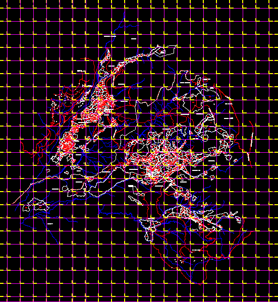
Base district Yanaquihua Arequipa in coordinates UTM and general cadaster
Drawing labels, details, and other text information extracted from the CAD file (Translated from Spanish):
broken totora, channel, broken caðipaco, Sihuaya ravine, broken supurpo, broken llango, broken chuccmullca, broken limb, broken yahuarccahua, broken totora, chojotocho, broken pine, channel, broken yahuarjahua, yanaquihua, c.c chila chila, sector totoral, chuquibamba, highway, road chuquibamba, district of ay, abandoned road, hill antipampa, broken yahuarjahua, hill solitude, road and chuquibamba road, road walk and, hill capaca, hill glory paw, big lick, sports, countryside, Cerro Achacmallca, walk and, district, walking village, eriazo, chilcal, sector, hill barru, district of yanaquihua, orato sector, pool hill, hill jana jahua, com., business sector, hill caðipaco, Cerro Achacmallca, road walk and, suppository, eriazo, little valley, town, più sector, district of yanaquihua, hill chuccmulla, eriazo, bullring, I closed the calvary, pond, yanaquihua town, road chuquibamba, eriazo, jopan hill, hill puca puca, hill calvary, hill gentle, road chuquibamba, puddle, town, hill aðasco, hill gentle, c. yanaquihua, punsahue, background, eriazo, Cerro Janajahua, puddle cc, hill huiscapaca, hill sunca, end of flight, no lack
Raw text data extracted from CAD file:
| Language | Spanish |
| Drawing Type | Block |
| Category | City Plans |
| Additional Screenshots |
 |
| File Type | dwg |
| Materials | |
| Measurement Units | |
| Footprint Area | |
| Building Features | Pool, Car Parking Lot |
| Tags | arequipa, autocad, base, beabsicht, block, borough level, cadaster, coordinates, district, DWG, general, political map, politische landkarte, proposed urban, road design, stadtplanung, straßenplanung, urban design, urban plan, utm, zoning |


