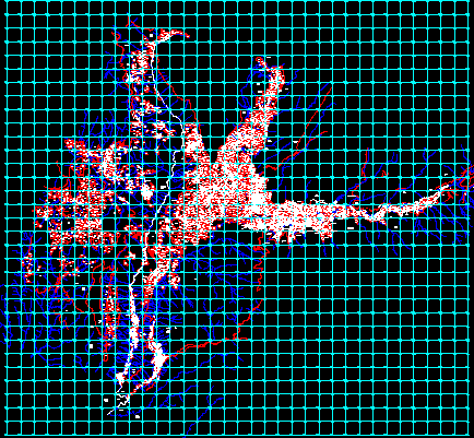
Huanca Base – Arequipa – Peru DWG Block for AutoCAD

Full digital land base and land sector of Huanca – Arequipa Peru – In coordinates UTM sector PETT COFOPRI
Drawing labels, details, and other text information extracted from the CAD file (Translated from Spanish):
district, huanca, district huanca, community, peasant, huanca, community, peasant community huanca, eriazo, zone, urban, path, eriazo, eriazo, annexed, puccro, eriazo, pain, glide, eriazo, glide, eriazo, eriazo, pain, eriazo, path, chivay, hill huaylluma, stay, hill surillacta, hill soconquima, sector achahue, pampa surrillacta, district huanca, horseshoe, puccro sector, eriazo, Hill, salvillayoc, eriazo, sector, eriazo, sector, district, rain, eriazo, abandoned, patacocha road, eriazo, patayarta canal, abandoned, eriazo, c.p. cunirca, abandoned, land, abandoned, Hill, jolluquita, Hill, board, Hill, sicserayoc, Hill, sicserayoc, sector, chaspirca, land abandoned by, change of campina, Hill, sicserayoc, Hill, flat hill, Hill, llactayoc, district chuta, annexed, Blackberry, road cunirca, abandoned, land, abandoned, ta, land, abandoned, ground, abandoned, eriazo, abandoned, eriazo, abandoned, eriazo, mountain, eriazo, pain, eriazo, path, zone, rocky, pain, eriazo, sector, I thank you, sector, acropunco, sector, chacapata, path, eriazo, Hill, arcopunco, Hill, aquinima, road tocroyo, path, zone, urban, path, eriazo, sanctuary, z. or., mountain, z.u., z.l., z.u., mountain, eriazo, path, I thank you, cloudy hill, highway, abandoned, sector mollepampa, tarhuaya sector, path, sector conatirca, cahucana sector, Sona sector, alley, sector poccas, malta sector, sector holds, paced alley, tarcuna alley, Malata annex, sector, pich, Cerro Huaranganillo Saracoto, eriazo, hill orkos, chuhuaya sector, expensive sector, allacta sector, pain, road villaran, huiturca sector, highway, arequipa, sector quiscahua, sector lihuaya, Cerro San Vicente, chinchana sector, hill huiturca vallillan, huanca, eriazo, mala, sector, tarcuna, eriazo, pullos sector, huanca, sector misamayoc, hill castle, zone, urban, eriazo, district chuta, road carving, eriazo, carving, eriazo, high san basilio, eriazo, z. urb., parsay sector, eriazo, Hill, murco, c.p., abandoned, eriazo, Hill, orkoltacta, eriazo, pain, abandoned, eriazo, abandoned, highway, rain, eriazo, abandoned, path, chuno, highway, huanca, abandoned, path, lag, sector, trap, eriazo, populated center, taya, abandoned, Hill, tolar, abandoned, eriazo, abandoned, eriazo, new Hope, eriazo, pain, eriazo, eriazo, abandoned, eriazo, pond, part, eriazo, sector, eriazo, district, rain, district, huanca, hill tingo, Cerro Jetacta, Cerrotiapayna, eriazo, sector, santa, Cecilia, Hill, quarry, district, rain, sector, huasamayo, eriazo, sector, pichinca, eriazo, district, huanca, Hill, yules, sector, santa, rita, eriazo, sector, sicse, Hill, what tick, eriazo, sector, seven, miles, eriazo, sector, parjay, eriazo, sihuas road, cemetery, zu, eriazo, path, eriazo, Sector Tahuayza, eriazo, eriazo, irrigation ditch, from town, vailillas, irrigation ditch, ravine, socconquima, ravine, huaylluma, ravine, sachahuani, What’s up?, ravine, irrigation ditch, principal, vailillas, irrigation ditch, principal, vailillas, ravine, irrigation ditch, puccro, big, puccro, boy, channel, platanayoc, ravine, chuhuana, River, chuhuana, River, ravine, quintessentially, ravine, cutter, qda., big, azaricma, qda., Author, River, pichiricha, pond triumph, San Miguel, qda., huaynapata, irrigation ditch, diatupampa, irrigation ditch, mother, qda., ccaccahuasi, taking, I thank you, taking, arcopunco, ravine, totorcaya, ravine, acayquipa, tower, ravine, tower, channel, I thank you, channel, tocroyo liguaya, River, I thank you
Raw text data extracted from CAD file:
| Language | Spanish |
| Drawing Type | Block |
| Category | City Plans |
| Additional Screenshots |
 |
| File Type | dwg |
| Materials | Other |
| Measurement Units | |
| Footprint Area | |
| Building Features | Car Parking Lot |
| Tags | arequipa, autocad, base, beabsicht, block, borough level, coordinates, digital, DWG, full, land, PERU, political map, politische landkarte, proposed urban, road design, sector, stadtplanung, straßenplanung, urban design, urban plan, zoning |


