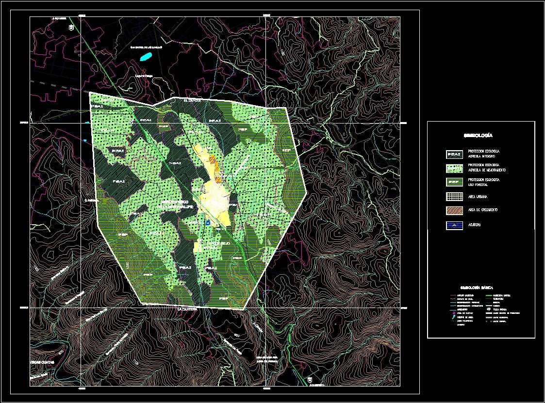
Arroyo Seco DWG Block for AutoCAD

Map of Mexico – Arroyo Seco-Urban Area of the Municipality of Arroyo Seco, Queretaro
Drawing labels, details, and other text information extracted from the CAD file (Translated from Spanish):
to. Cordova, c. huizache, canyon leech, canyon the pools, canyon the bows, c. the quarry, red stone canyon, canyon, barranca guayacal, nitrate barge, lagoon conga, the sapote, the knoll, old tank, las vegas, cold water table, of the, the quarry, ajoshi ravine, basic symbology, san rafael of the lunillas, dry, growing area, aqueduct, intermittent, contour lines, master curves, state highway, population center, urban trace, sidewalk, gap, terrace, perennial, growing area, aqueduct, intermittent, contour lines, master curves, state highway, urban trace, sidewalk, gap, terrace, perennial, growing area, aqueduct, intermittent, contour lines, master curves, state highway, urban trace, sidewalk, gap, terrace, perennial, growing area, aqueduct, intermittent, contour lines, master curves, state highway, urban trace, sidewalk, gap, terrace, perennial, body of water, growing area, aqueduct, intermittent, contour lines, master curves, state highway, urban trace, sidewalk, gap, terrace, perennial, boundary, municipal, state, telephone line, mex, mex, green River, cadereyta, current urban, ecological protection, Urban area, growth area, intensive farming, ecological protection, agricultural improvement, ecological protection, forest use, aquifer, of growth
Raw text data extracted from CAD file:
| Language | Spanish |
| Drawing Type | Block |
| Category | City Plans |
| Additional Screenshots |
 |
| File Type | dwg |
| Materials | |
| Measurement Units | |
| Footprint Area | |
| Building Features | Pool, Car Parking Lot |
| Tags | area, autocad, beabsicht, block, borough level, DWG, map, mexico, municipality, political map, politische landkarte, proposed urban, queretaro, road design, seco, stadtplanung, straßenplanung, urban design, urban plan, zoning |
Related Products
Same Contributor


Featured Products


