Basemap Arequipa DWG Detail for AutoCAD
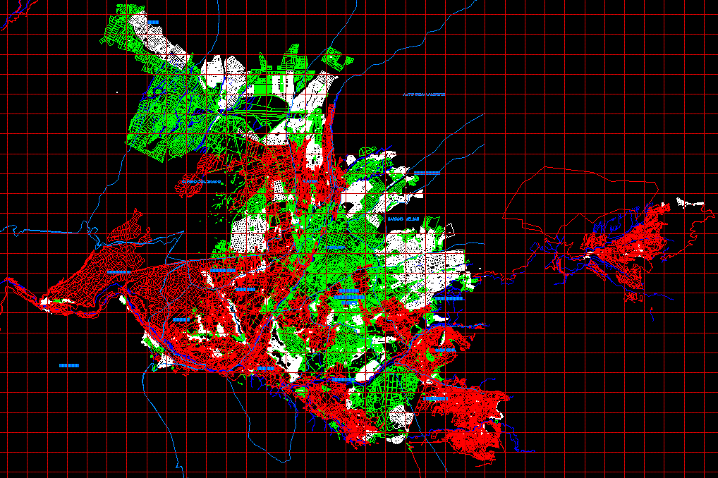
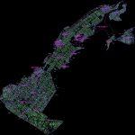
Basemap department of Arequipa – Detail Miraflores District
Drawing labels, details, and other text information extracted from the CAD file (Translated from Spanish):
base arequipa, office of extended jurisdiction arequipa, April of, technical area, rio socabaya, rio chili, channel, irrigation ditch, pond, cracked, of water, outcrop zone, rio yura, pond, capua ravine, rio yura, pond, old yura canal, new chacra canal, coronary artery, capua ravine, pond, channel, rio yura, channel, pond, old yura canal, lateral canal, pond, channel, rio yura, channel, pond, lateral canal, hot springs, pond, side, sublateral canal, pond, side, hot springs, lateral canal, sub-lateral channel, lateral canal, side, main channel, sub-lateral channel, rio yura, mother channel quiscos uyupampa, yura, bridge, z.l., coronary smear, capua, particular, own take, wells, milestone juana, Street, bare, milestone, pond, take hot waters, loclla, Hot water, huambo road, reasoned, eriazo, pond, side, railroad track, road of the yura cement factory, yura, bridge, district of yura, road yura la calera, road matarrayo maucallacta, road uyupampa, togroyo road, horseshoe path, yura carretra, huambo road, canal road quiscos uyupampa, railroad track, access road, road to cuzco, abandoned, carriageway, railroad track, bridge, pond, arequipa road, district of yura, railroad track, road to cuzco, quiscos, railroad line, clan, milestone, main street quiscos, hunter, arequipa, cayman, happy jungle high, miraflores, Mariano Melgar, socabaya, Jose Luis, Bustamante, red hill, rivero, paucarpata, sabandia, mollebaya, yura, uchumayo, tiabaya, sachaca, yanahuara, uchumayo, sogay, pampas new of san antonio, the hill, yarabamba, quebec, fernando belaunde terry, mollebaya, yanayaco, Cacapata, good view, coal, the huaylla, san cosme, characato, san francisco de characato, expansion island, sabandia, ccoripata, yumina, Santa Maria, horacio zeballos, the Pampa, the street, high good view, the mirador socabaya, the town of socabaya, santa cruz de lara, San Cristobal, socabaya the countryside good view, villa hope, countryside, the countryside, countryside iii, the willows, the emeralds sector, Simon Bolivar, lara, villa field fair, of August, south lion, andres avelino caceres sector, Saint John Baptist, hunter, big tinge, tiabaya, alata, high alata, high the mill, mark, steps of the Lord, general pedro vilcapaza, heart of jesus sector, the chiriguna, of July, jose maria arguedas, tall of loved ones, tasahuayo, the olive trees, my turkey, Mars field, the twig, plot, high jesus, paucarpata expansion, California, manco capac, Viña del Mar, Cesar Vallejo, villa maria del triunfo, Jesus Maria, morale, jose carlos mariategui, p. diaz, of August, Jorge chavez, meliton carbajal, December nine, Saint Rose, Mariano Melgar, high mariano melgar, I shut the chilca, santa rita de casia, Mariano Bustamante, Mount Olympus, cenepa heroes, free town, the Angels, little belen, jose maria arguedas ii, villa maria montessori, jose maria arguedas, the corner place, the roses, Arequipa, Jerusalem, generalisimo jose de san martin, Peruvian revolution, arturo villegas, nicolas de pierola, New Delhi, sons of degree, terminal calvary, las vegas garlic, plot, union builders el
Raw text data extracted from CAD file:
| Language | Spanish |
| Drawing Type | Detail |
| Category | City Plans |
| Additional Screenshots |
   |
| File Type | dwg |
| Materials | Other |
| Measurement Units | |
| Footprint Area | |
| Building Features | Car Parking Lot, Garden / Park |
| Tags | arequipa, autocad, beabsicht, borough level, department, DETAIL, district, DWG, miraflores, political map, politische landkarte, proposed urban, road design, stadtplanung, straßenplanung, urban design, urban plan, zoning |


