Bonfil Amelaco DWG Block for AutoCAD

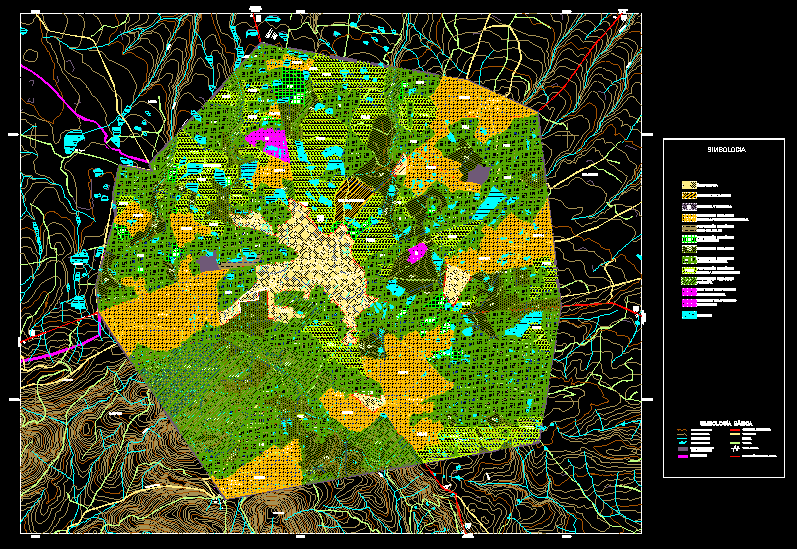
Maps of Mexico – Township Amelaco de Bonfil – Queretaro urban map
Drawing labels, details, and other text information extracted from the CAD file (Translated from Spanish):
basic symbology, terrace, master curves, urban trace, sidewalk, gap, terrace, runoff, contour lines, body of water, paved road, current population center limit, symbology, current urban area boundary, mex, qro, qro, mex, mex, qro, qro, qro, amoeba, san juan dehedo, loneliness, the capulin, chiteje, from the cross, junction, with road, fed. do not., long plain, to. the island, the island, to. deep, The baby goat, the brotherhood, to. Colorado, San Miguel, deheti, San Juan, from the river, White water, the anima, san antonio, White water, san ildefonso, tultepec, b. the lagoon, Ranch, deep stream, the ash, Ranch, the wonders, crown, c. the cross of san juan, c. chatemage cross, the capulin, canoes canyon, c. beautiful peak, Ranch, c. Saint Rose, chiteje, corner of the, fracc. Saint Joseph, san josé itho, san pedro, Santiago, Florida, of the oaks, mexican, new dawn, pep, ecological protection, equipment, ecological protection, industry services, Urban area, aquifer, growth area, peum, peai, peam, pef, peum, pep, peai, peaph, peam, pef, Urban area, hill park, filling, residual discharges, sanitary, of the roosters, growth area, infrastructure, equipment, recreation, state limit, ecological protection, peaph, multiple uses, livestock use, intensive farming, agricultural improvement, forest, peaph, peai, peam, peai
Raw text data extracted from CAD file:
| Language | Spanish |
| Drawing Type | Block |
| Category | City Plans |
| Additional Screenshots |
 |
| File Type | dwg |
| Materials | Other |
| Measurement Units | |
| Footprint Area | |
| Building Features | Car Parking Lot, Garden / Park |
| Tags | autocad, beabsicht, block, borough level, de, DWG, map, maps, mexico, political map, politische landkarte, proposed urban, queretaro, road design, stadtplanung, straßenplanung, township, urban, urban design, urban plan, zoning |


