Model Subdivision U1 DWG Model for AutoCAD
Model of subdivision with UTM coordinates
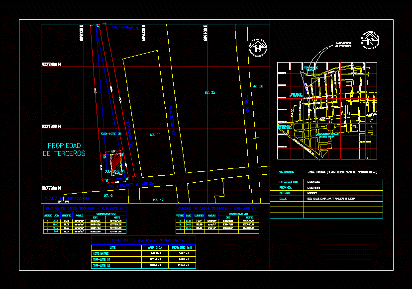
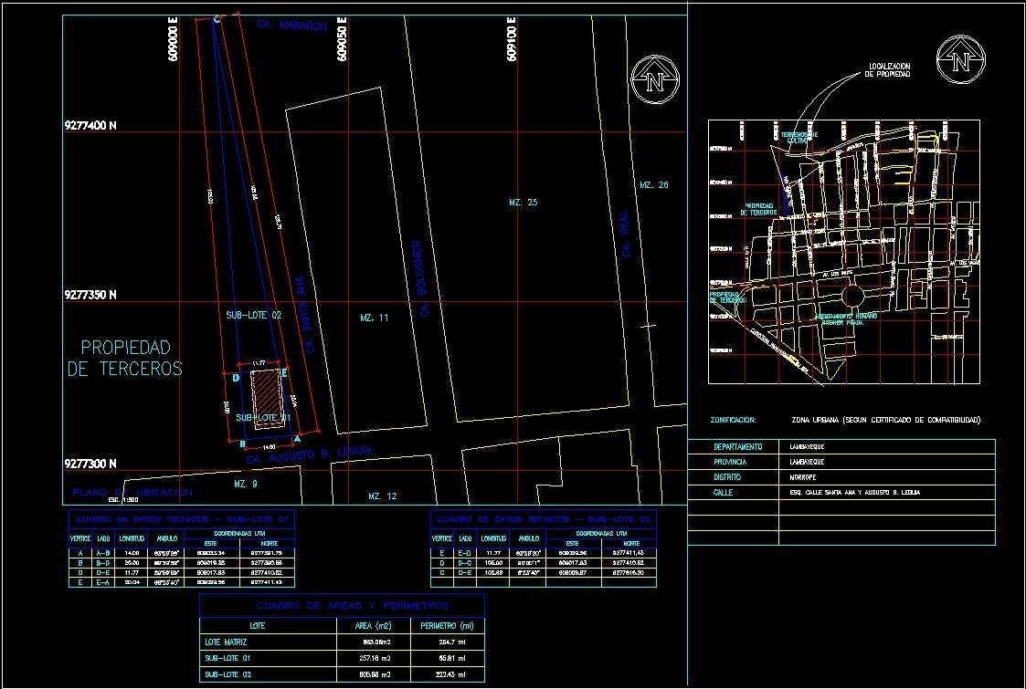
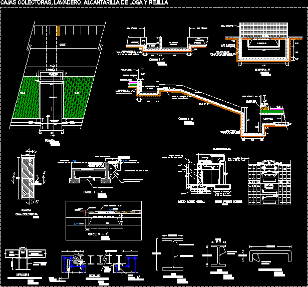
Drawing labels, details, and other text information extracted from the CAD file (Translated from Spanish):
Saint Matthew, San Ignacio, flowers, begonias, lilies, jasmine, Saint George, spring, av. sinchi rock, the acacias, mastuerdos, violets, laurels, lilacs, san genaro, dawn, orchids, san justo, myrtles, gardenias, carnations, the sunflowers, san juan bosco, San Jacinto, Cactus, cantuta, amancaes, the nisperos, the grenades, pje the sour cherries, the cherries, strawberries, datiles, poplars, plums, the mangoes, av. university, coop. for housing the dawn, san gualberto, san j. baptist, observations, date, date of plot:, draft, specialty, design, scale, date, reviewed, Location, flat, professional, sheet, association of jehova witnesses, av. the cortijo nº, monterrico boy, stgo. of groove lima, temple, religious, architecture, distribution, general, gracia torreblanca r., architect, chap., g.t., me., ocsr, month, file, month, third-party, property, AC. progress, av. tahuantinsuyo, Pan American Highway km, av. Pan American, third-party, property, third-party, property, AC. augusto b. leguia, culture, land of, AC. cashew, AC. the rosary, AC. san pedro, AC. real, AC. san antonio, av. tahuantinsuyo, jr. alone, av. Mexico, AC. Saint Joseph, AC. bolognesi, AC. San Martin, AC. Saint Ana, AC. the mercedes, AC. Saint Rose, AC. the looker, AC. bolognesi, av. tahuantinsuyo, av. Mexico, av. tupac amaru, av. the Incas, AC. Saint Ana, AC. the looker, av. the Incas, AC. the rosary, Pan American Highway km, ritcher prada, human settlement, Street, AC. grade, AC. augusto b. leguia, esc., location map, Street, esq. street santa ana augusto b. leguia, province, district, morrope, lambayeque, zoning:, urban area certified, property location, Department, lambayeque, AC. augusto b. leguia, AC. Saint Ana, AC. cashew, AC. real, AC. bolognesi, mz., north, length, technical data box, side, vertex, angle, East, utm coordinates, north, length, technical data box, side, vertex, angle, East, utm coordinates, table of perimeter areas, batch matrix, perimeter, lot, area
Raw text data extracted from CAD file:
| Language | Spanish |
| Drawing Type | Model |
| Category | City Plans |
| Additional Screenshots |
 |
| File Type | dwg |
| Materials | |
| Measurement Units | |
| Footprint Area | |
| Building Features | Car Parking Lot, Garden / Park |
| Tags | autocad, beabsicht, borough level, coordinates, DWG, model, political map, politische landkarte, proposed urban, road design, stadtplanung, straßenplanung, subdivision, urban design, urban plan, utm, zoning |
Related Products

Same Contributor

Featured Products


