Neighborhood Road Rehabilitation DWG Section for AutoCAD
PLANE LOCATION;SIGNALING PLANES; PLANT -PROFILES -SECTIONS; DETAILS; QWARRY DISTANCE; QWARRY OF TRANSPORTATION; LOCATION OF WATER SOURCES.
Drawing labels, details, and other text information extracted from the CAD file (Translated from Spanish):
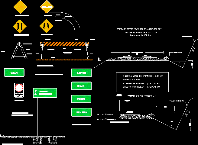
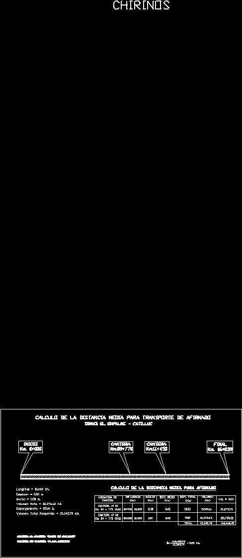
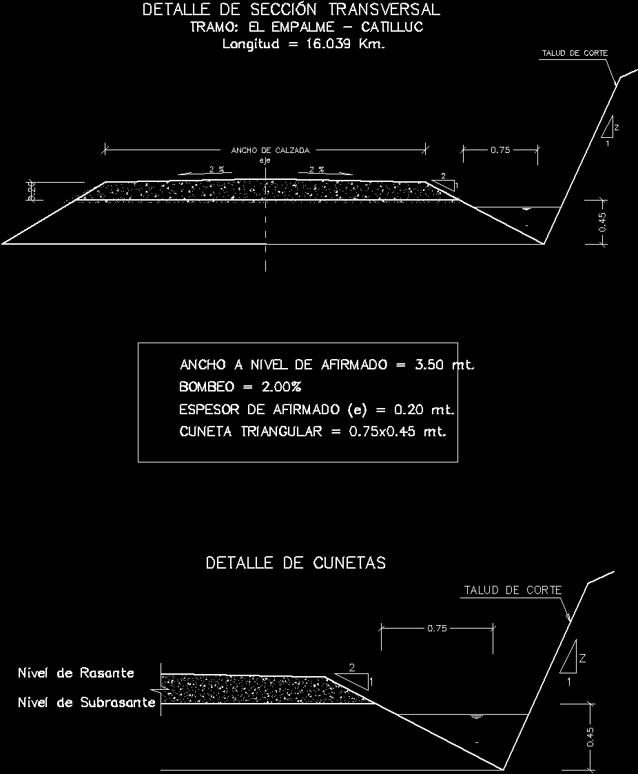
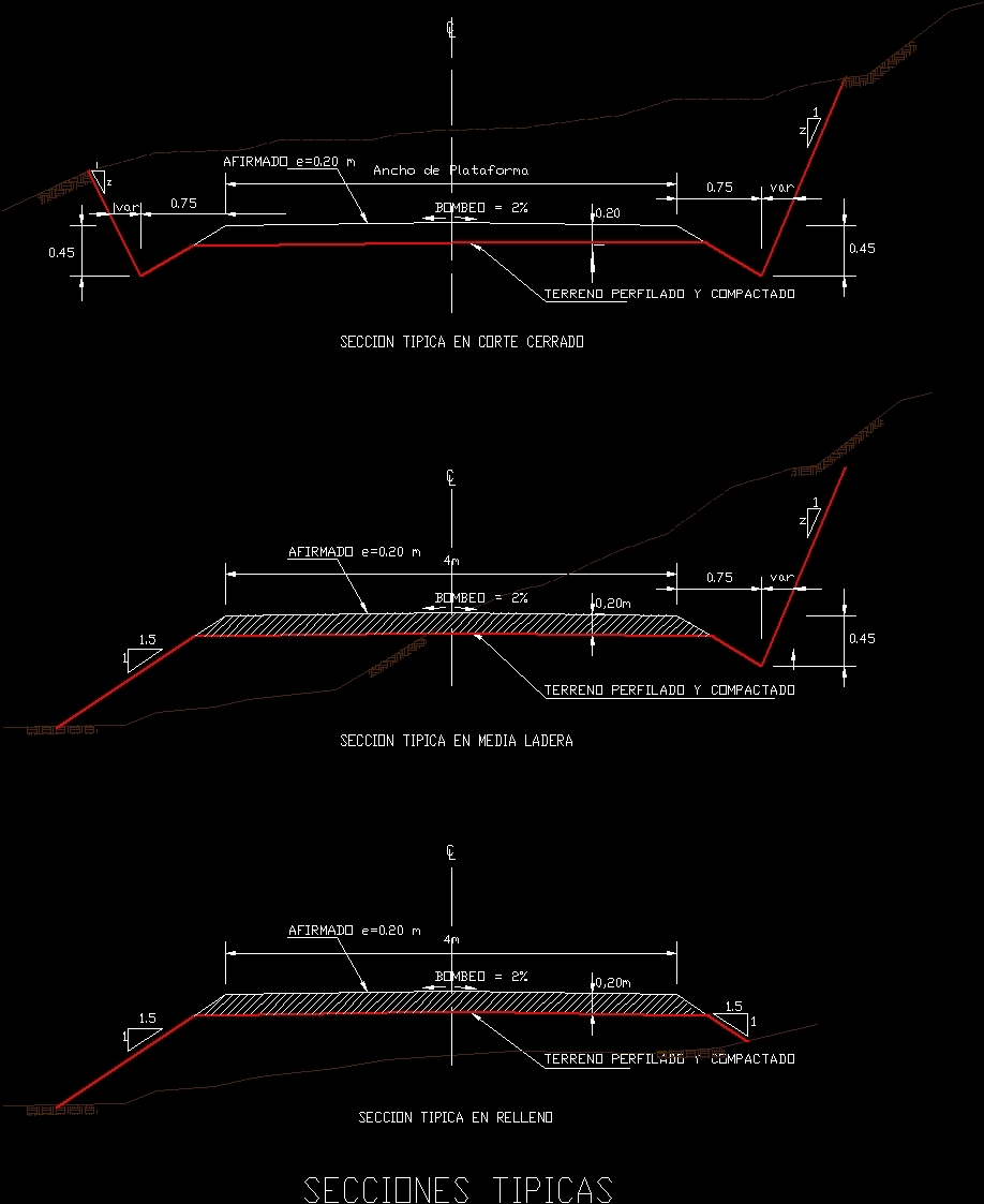
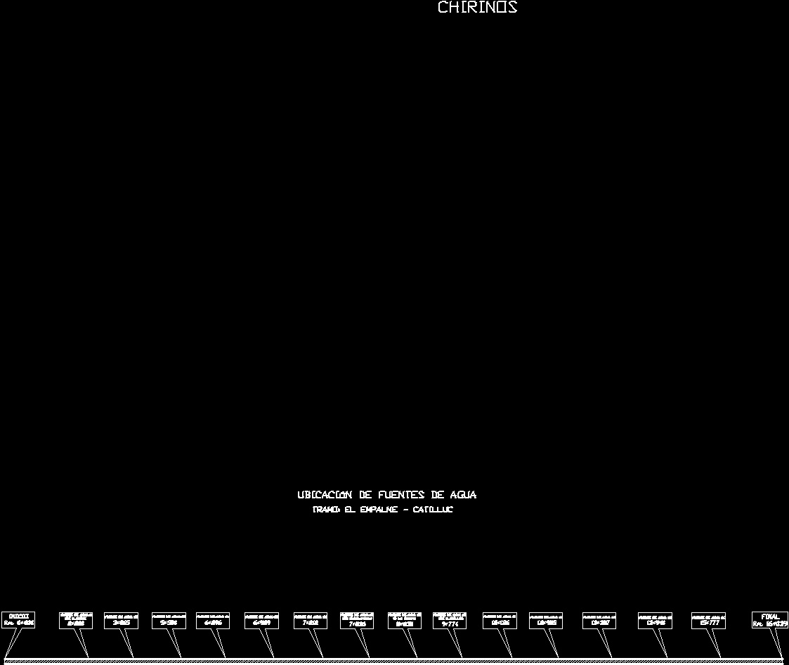
section: the junction – catilluc, axis, roadway width, cross section detail, cut slope, subgrade level, grade level, gutter detail, chirinos, calculation of the average distance for transporting the road, beginning, end, quarry, calculation of the average distance for affirmed, location of, influence, access, dist. average, dist. total, volume, total, var, profiled and compacted terrain, typical section in fill, platform width, typical section on average hillside, typical section in closed section, typical sections, location of quarries, start, quilcate quarry, quarry Hermoza beach, location of water sources, river plantain, quishuarbado river, q. the totora, river llanallpa
Raw text data extracted from CAD file:
| Language | Spanish |
| Drawing Type | Section |
| Category | Roads, Bridges and Dams |
| Additional Screenshots |
     |
| File Type | dwg |
| Materials | Other |
| Measurement Units | Metric |
| Footprint Area | |
| Building Features | |
| Tags | autocad, cajamarca, details, DWG, HIGHWAY, neighborhood, pavement, plane, PLANES, plant, profiles, rehabilitation, Road, route, section, sections |
Related Products


Same Contributor

Featured Products


