Choose Your Desired Option(s)
×ADVERTISEMENT

ADVERTISEMENT
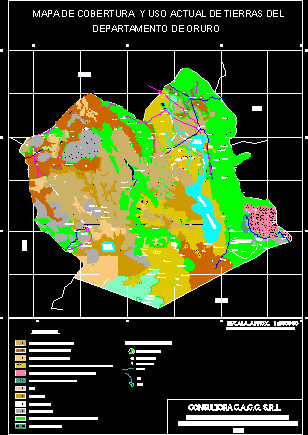
Map Oruro Zone – Covering of lands – Bolivia
| Language | Other |
| Drawing Type | Block |
| Category | City Plans |
| Additional Screenshots | |
| File Type | dwg |
| Materials | |
| Measurement Units | Metric |
| Footprint Area | |
| Building Features | |
| Tags | autocad, beabsicht, block, bolivia, borough level, covering, DWG, lands, map, oruro, political map, politische landkarte, proposed urban, road design, stadtplanung, straßenplanung, urban design, urban plan, zone, zoning |
ADVERTISEMENT
Download Details
$3.87
Release Information
-
Price:
$3.87
-
Categories:
-
Released:
April 15, 2018


