Subdivision, Land Use, Zoning–Peru DWG Block for AutoCAD
ADVERTISEMENT

ADVERTISEMENT
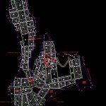
Lotización; LAND USE, ZONING
Drawing labels, details, and other text information extracted from the CAD file (Translated from Spanish):
posta, unchuran ravine, ravine, manzanahuran ravine, anashuran ravine, inei, road, main road, plaza toribio saint, barrio toribio, pampa neighborhood, wichy district, school, municipality, plaza, church, stadium, initial center, road, road Horseshoe, street, road to crus de mayo, c c ‘, b b’, c c ‘, b b’, a a ‘, d d’, d d ‘, a a’, education, other uses, barrier, wichyuran, tomairca catac
Raw text data extracted from CAD file:
| Language | Spanish |
| Drawing Type | Block |
| Category | Condominium |
| Additional Screenshots |
 |
| File Type | dwg |
| Materials | Other |
| Measurement Units | Metric |
| Footprint Area | |
| Building Features | |
| Tags | apartment, autocad, block, building, condo, DWG, eigenverantwortung, Family, group home, grup, land, mehrfamilien, multi, multifamily housing, ownership, partnerschaft, partnership, subdivision, zoning |


