Topographic Survey DWG Section for AutoCAD
ADVERTISEMENT
ADVERTISEMENT
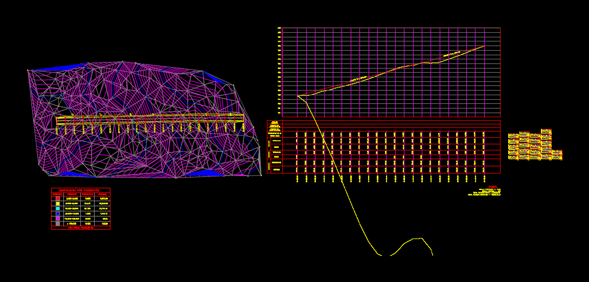
It has polygonal; contruccion box; calculating slopes; sections of terrain and road cuts
Drawing labels, details, and other text information extracted from the CAD file (Translated from Spanish):
type, material, factor, abundance, compaction, ordinates, mass curve, embankment, cut, subgrade, terrain, volume, thickness, elevation, profile, slope zoning, symbology, slope, percentage
Raw text data extracted from CAD file:
| Language | Spanish |
| Drawing Type | Section |
| Category | Handbooks & Manuals |
| Additional Screenshots | |
| File Type | dwg |
| Materials | Other |
| Measurement Units | Metric |
| Footprint Area | |
| Building Features | |
| Tags | autocad, box, cuts, DWG, Road, section, sections, slopes, survey, terrain, topographic |
Related Products


Same Contributor


Featured Products


