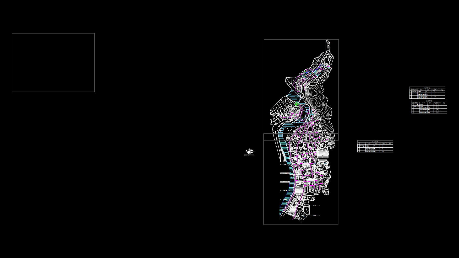
Topographic Map Of The City Of St Hilarion – Peru DWG Block for AutoCAD

Topographic Map of the city of St. Hilarion – Peru
Drawing labels, details, and other text information extracted from the CAD file (Translated from Spanish):
jr., Garden of, jr., fernando belaunde terry, beautiful view, windmill, prolg. ucayali, prolg. jose galvez, windmill, tap, jr., prolg. cashew, prolg. huallaga, j.c.m., c.n. j.c.m., prolg. Amazon, jr., lagoon, windmill, c.e.p., lagoon, stadium, lagoon, tarapoto, jr., jr., market, evangelical, church, c. Health, church, catholic, jr., suspension bridge, right edge, left edge, parade ground, children, municipal, paleness, jr. san hilarion, holy field nº, cemetery nº, sports field, description, city, road fernando belaunde terry, symbol, sisa river, contour lines, June, topographic map, scale:, Map:, map of hazards of the city of san hilarion, study:, date:, flat:, new, sustainable cities, indeci
Raw text data extracted from CAD file:
| Language | Spanish |
| Drawing Type | Block |
| Category | City Plans |
| Additional Screenshots |
 |
| File Type | dwg |
| Materials | |
| Measurement Units | |
| Footprint Area | |
| Building Features | Car Parking Lot, Garden / Park |
| Tags | autocad, beabsicht, block, borough level, cadastre, city, DWG, map, PERU, political map, politische landkarte, proposed urban, road design, st, stadtplanung, straßenplanung, topographic, urban design, urban plan, zoning |
Related Products

Same Contributor
Featured Products


